Sítio do Mato
Município de Sítio do Mato | |
|---|---|
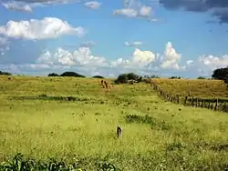 Vegetation in Sítio do Mato, Bahia | |
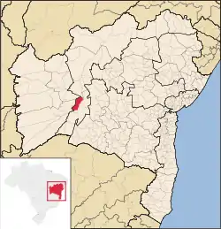 Location of Sítio do Mato in Bahia | |
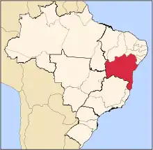
 Sítio do Mato Location of Sítio do Mato in Brazil | |
| Coordinates: 13°05′06″S 43°27′54″W / 13.08500°S 43.46500°W | |
| Country | |
| Region | Northeast |
| State | |
| Government | |
| • Mayor | Alfredo de Oliveira Magalhaes Junior |
| Area | |
| • Total | 1,627.776 km2 (628.488 sq mi) |
| Elevation | 428 m (1,404 ft) |
| Population (2020 [1]) | |
| • Total | 13,059 |
| • Density | 8.0/km2 (21/sq mi) |
| Demonym | Sítio-matense |
| Time zone | UTC−3 (BRT) |
Sítio do Mato is a municipality in the state of Bahia in the North-East region of Brazil. Sítio do Mato covers 1,627.776 km2 (628.488 sq mi), and has a population of 13,059 with a population density of 8.1 inhabitants per square kilometer.[2]
See also
References
- ↑ IBGE 2020
- ↑ "Sítio do Mato" (in Portuguese). Brasília, Brazil: Instituto Brasileiro de Geografia e Estatística. 2015. Retrieved 2015-06-14.
This article is issued from Wikipedia. The text is licensed under Creative Commons - Attribution - Sharealike. Additional terms may apply for the media files.