Saint-Pierre-de-Rivière | |
|---|---|
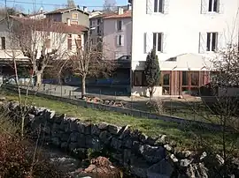 The school in Saint-Pierre-de-Rivière | |
Location of Saint-Pierre-de-Rivière | |
 Saint-Pierre-de-Rivière  Saint-Pierre-de-Rivière | |
| Coordinates: 42°57′42″N 1°33′37″E / 42.9617°N 1.5603°E | |
| Country | France |
| Region | Occitania |
| Department | Ariège |
| Arrondissement | Foix |
| Canton | Foix |
| Intercommunality | CA Pays Foix-Varilhes |
| Government | |
| • Mayor (2020–2026) | Véronique Rumeau[1] |
| Area 1 | 2.35 km2 (0.91 sq mi) |
| Population | 674 |
| • Density | 290/km2 (740/sq mi) |
| Time zone | UTC+01:00 (CET) |
| • Summer (DST) | UTC+02:00 (CEST) |
| INSEE/Postal code | 09273 /09000 |
| Elevation | 436–569 m (1,430–1,867 ft) (avg. 451 m or 1,480 ft) |
| 1 French Land Register data, which excludes lakes, ponds, glaciers > 1 km2 (0.386 sq mi or 247 acres) and river estuaries. | |
Saint-Pierre-de-Rivière (French pronunciation: [sɛ̃ pjɛʁ də ʁivjɛʁ]; Languedocien: Sent Pèire) is a commune in the Ariège department in southwestern France.
Population
| Year | Pop. | ±% p.a. |
|---|---|---|
| 1968 | 318 | — |
| 1975 | 349 | +1.34% |
| 1982 | 418 | +2.61% |
| 1990 | 463 | +1.29% |
| 1999 | 564 | +2.22% |
| 2009 | 676 | +1.83% |
| 2014 | 613 | −1.94% |
| 2020 | 668 | +1.44% |
| Source: INSEE[3] | ||
Inhabitants of Saint-Pierre-de-Rivière are called Saint-Pierrois in French.
See also
References
- ↑ "Répertoire national des élus: les maires". data.gouv.fr, Plateforme ouverte des données publiques françaises (in French). 9 August 2021.
- ↑ "Populations légales 2021". The National Institute of Statistics and Economic Studies. 28 December 2023.
- ↑ Population en historique depuis 1968, INSEE
Wikimedia Commons has media related to Saint-Pierre-de-Rivière.
This article is issued from Wikipedia. The text is licensed under Creative Commons - Attribution - Sharealike. Additional terms may apply for the media files.