Saint-Ybars | |
|---|---|
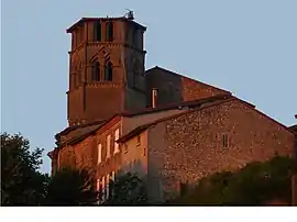 The church in Saint-Ybars | |
.svg.png.webp) Coat of arms | |
Location of Saint-Ybars | |
 Saint-Ybars  Saint-Ybars | |
| Coordinates: 43°14′19″N 1°23′12″E / 43.2386°N 1.3867°E | |
| Country | France |
| Region | Occitania |
| Department | Ariège |
| Arrondissement | Saint-Girons |
| Canton | Arize-Lèze |
| Government | |
| • Mayor (2020–2026) | Francis Boy[1] |
| Area 1 | 24.31 km2 (9.39 sq mi) |
| Population | 688 |
| • Density | 28/km2 (73/sq mi) |
| Time zone | UTC+01:00 (CET) |
| • Summer (DST) | UTC+02:00 (CEST) |
| INSEE/Postal code | 09277 /09210 |
| Elevation | 213–334 m (699–1,096 ft) (avg. 290 m or 950 ft) |
| 1 French Land Register data, which excludes lakes, ponds, glaciers > 1 km2 (0.386 sq mi or 247 acres) and river estuaries. | |
Saint-Ybars is a commune in the Ariège department in southwestern France.
Population
Inhabitants of Saint-Ybars are called Eparchois.
| Year | Pop. | ±% |
|---|---|---|
| 1962 | 635 | — |
| 1968 | 654 | +3.0% |
| 1975 | 524 | −19.9% |
| 1982 | 476 | −9.2% |
| 1990 | 512 | +7.6% |
| 1999 | 561 | +9.6% |
| 2008 | 649 | +15.7% |
Geography
The Lèze forms part of the commune's western border.
See also
References
- ↑ "Répertoire national des élus: les maires". data.gouv.fr, Plateforme ouverte des données publiques françaises (in French). 2 December 2020.
- ↑ "Populations légales 2021". The National Institute of Statistics and Economic Studies. 28 December 2023.
Wikimedia Commons has media related to Saint-Ybars.
This article is issued from Wikipedia. The text is licensed under Creative Commons - Attribution - Sharealike. Additional terms may apply for the media files.