Sainte-Marie | |
|---|---|
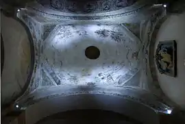 The interior of the dome of the church of Sainte-Agathe | |
Location of Sainte-Marie | |
 Sainte-Marie  Sainte-Marie | |
| Coordinates: 44°52′42″N 2°53′10″E / 44.8783°N 2.8861°E | |
| Country | France |
| Region | Auvergne-Rhône-Alpes |
| Department | Cantal |
| Arrondissement | Saint-Flour |
| Canton | Saint-Flour-2 |
| Intercommunality | Saint-Flour Communauté |
| Government | |
| • Mayor (2020–2026) | Pierre Seguis[1] |
| Area 1 | 17.87 km2 (6.90 sq mi) |
| Population | 109 |
| • Density | 6.1/km2 (16/sq mi) |
| Time zone | UTC+01:00 (CET) |
| • Summer (DST) | UTC+02:00 (CEST) |
| INSEE/Postal code | 15198 /15230 |
| Elevation | 620–1,055 m (2,034–3,461 ft) (avg. 840 m or 2,760 ft) |
| 1 French Land Register data, which excludes lakes, ponds, glaciers > 1 km2 (0.386 sq mi or 247 acres) and river estuaries. | |
Sainte-Marie (French pronunciation: [sɛ̃t maʁi] ⓘ; Auvergnat: Senta Mària) is a commune in the Cantal department in south-central France.
Population
| Year | Pop. | ±% |
|---|---|---|
| 1962 | 156 | — |
| 1968 | 185 | +18.6% |
| 1975 | 152 | −17.8% |
| 1982 | 133 | −12.5% |
| 1990 | 125 | −6.0% |
| 1999 | 107 | −14.4% |
| 2008 | 112 | +4.7% |
| 2016 | 110 | −1.8% |
See also
References
- ↑ "Répertoire national des élus: les maires" (in French). data.gouv.fr, Plateforme ouverte des données publiques françaises. 13 September 2022.
- ↑ "Populations légales 2021". The National Institute of Statistics and Economic Studies. 28 December 2023.
Wikimedia Commons has media related to Sainte-Marie (Cantal).
This article is issued from Wikipedia. The text is licensed under Creative Commons - Attribution - Sharealike. Additional terms may apply for the media files.