Schönberg am Kamp | |
|---|---|
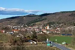 View from south | |
 Coat of arms | |
 Schönberg am Kamp Location within Austria | |
| Coordinates: 48°31′N 15°42′E / 48.517°N 15.700°E | |
| Country | Austria |
| State | Lower Austria |
| District | Krems-Land |
| Government | |
| • Mayor | Michael Strommer, ÖVP |
| Area | |
| • Total | 53.28 km2 (20.57 sq mi) |
| Elevation | 226 m (741 ft) |
| Population (2018-01-01)[2] | |
| • Total | 1,903 |
| • Density | 36/km2 (93/sq mi) |
| Time zone | UTC+1 (CET) |
| • Summer (DST) | UTC+2 (CEST) |
| Postal code | 3564 |
| Area code | 02733 |
| Website | www.schoenberg.gv.at |
Schönberg am Kamp is a town in the district of Krems-Land in the Austrian state of Lower Austria.
Population
| Year | Pop. | ±% |
|---|---|---|
| 1923 | 2,596 | — |
| 1951 | 2,408 | −7.2% |
| 1961 | 2,130 | −11.5% |
| 1971 | 2,034 | −4.5% |
| 1981 | 1,914 | −5.9% |
| 1991 | 1,881 | −1.7% |
| 2001 | 1,901 | +1.1% |
References
- ↑ "Dauersiedlungsraum der Gemeinden Politischen Bezirke und Bundesländer - Gebietsstand 1.1.2018". Statistics Austria. Retrieved 10 March 2019.
- ↑ "Einwohnerzahl 1.1.2018 nach Gemeinden mit Status, Gebietsstand 1.1.2018". Statistics Austria. Retrieved 9 March 2019.

This article is issued from Wikipedia. The text is licensed under Creative Commons - Attribution - Sharealike. Additional terms may apply for the media files.