Shelly Beach
Aotea | |
|---|---|
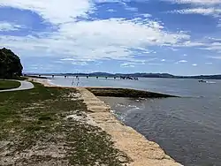 Jetty at Shelly Beach | |
| Coordinates: 36°34′20″S 174°22′45″E / 36.57222°S 174.37917°E | |
| Country | New Zealand |
| Region | Auckland Region |
| Ward | Rodney ward |
| Community board | Rodney Local Board |
| Electorates | |
| Government | |
| • Territorial Authority | Auckland Council |
| Area | |
| • Total | 0.31 km2 (0.12 sq mi) |
| Population (June 2023)[2] | |
| • Total | 270 |
| • Density | 870/km2 (2,300/sq mi) |
Shelly Beach (Māori: Aotea), officially known as Aotea / Shelly Beach, is a settlement and beach located on the eastern side of Te Korowai-o-Te-Tonga Peninsula and the southwest side of Kaipara Harbour, North Auckland.[3] In 2018, a seawall and five groynes were constructed to fight erosion.[4]
Demographics
Statistics New Zealand describes Shelly Beach as a rural settlement, which covers 0.31 km2 (0.12 sq mi)[1] and had an estimated population of 270 as of June 2023,[2] with a population density of 871 people per km2. Shelly Beach is part of the larger South Head statistical area.[5]
| Year | Pop. | ±% p.a. |
|---|---|---|
| 2006 | 153 | — |
| 2013 | 234 | +6.26% |
| 2018 | 252 | +1.49% |
| Source: [6] | ||
Shelly Beach had a population of 252 at the 2018 New Zealand census, an increase of 18 people (7.7%) since the 2013 census, and an increase of 99 people (64.7%) since the 2006 census. There were 105 households, comprising 129 males and 120 females, giving a sex ratio of 1.07 males per female, with 51 people (20.2%) aged under 15 years, 30 (11.9%) aged 15 to 29, 132 (52.4%) aged 30 to 64, and 42 (16.7%) aged 65 or older.
Ethnicities were 91.7% European/Pākehā, 16.7% Māori, 8.3% Pacific peoples, 1.2% Asian, and 1.2% other ethnicities. People may identify with more than one ethnicity.
Although some people chose not to answer the census's question about religious affiliation, 63.1% had no religion, 23.8% were Christian, 1.2% were Muslim and 1.2% had other religions.
Of those at least 15 years old, 21 (10.4%) people had a bachelor's or higher degree, and 39 (19.4%) people had no formal qualifications. 36 people (17.9%) earned over $70,000 compared to 17.2% nationally. The employment status of those at least 15 was that 99 (49.3%) people were employed full-time, 24 (11.9%) were part-time, and 3 (1.5%) were unemployed.[6]
References
- 1 2 "ArcGIS Web Application". statsnz.maps.arcgis.com. Retrieved 12 May 2022.
- 1 2 "Subnational population estimates (RC, SA2), by age and sex, at 30 June 1996-2023 (2023 boundaries)". Statistics New Zealand. Retrieved 25 October 2023. (regional councils); "Subnational population estimates (TA, SA2), by age and sex, at 30 June 1996-2023 (2023 boundaries)". Statistics New Zealand. Retrieved 25 October 2023. (territorial authorities); "Subnational population estimates (urban rural), by age and sex, at 30 June 1996-2023 (2023 boundaries)". Statistics New Zealand. Retrieved 25 October 2023. (urban areas)
- ↑ Harriss, Gavin (March 2022). Shelly Beach, Auckland (Map). NZ Topo Map.
- ↑ "Council plans to build seawall and walkway at Shelly Beach". Stuff. 26 June 2018. Retrieved 18 November 2021.
- ↑ 2018 Census place summary: South Head
- 1 2 "Statistical area 1 dataset for 2018 Census". Statistics New Zealand. March 2020. 7001259 and 7001260.