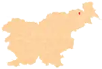
Spodnja Ročica | |
|---|---|
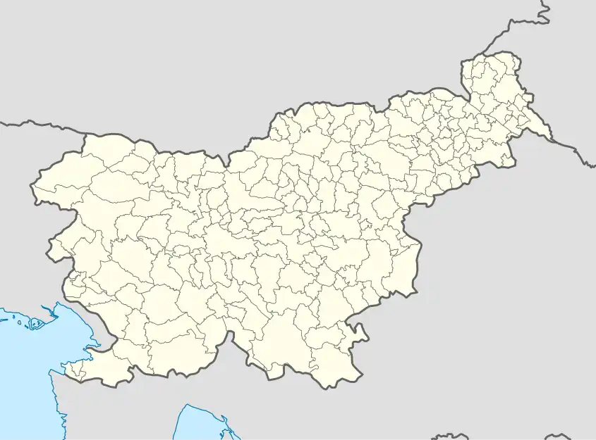 Spodnja Ročica Location in Slovenia | |
| Coordinates: 46°37′14.99″N 15°51′21.39″E / 46.6208306°N 15.8559417°E | |
| Country | |
| Traditional region | Styria |
| Statistical region | Drava |
| Municipality | Benedikt |
| Area | |
| • Total | 1.7 km2 (0.7 sq mi) |
| Elevation | 308.9 m (1,013.5 ft) |
| Population (2020) | |
| • Total | 124 |
| • Density | 73/km2 (190/sq mi) |
| [1] | |
Spodnja Ročica (pronounced [ˈspoːdnja ɾɔˈtʃiːtsa]) is a settlement in the Municipality of Benedikt in northeastern Slovenia. It lies in the Slovene Hills (Slovene: Slovenske gorice). The area is part of the traditional region of Styria and is now included in the Drava Statistical Region.[2]
Fourteen partly destroyed Roman-period burial mounds have been identified near the settlement.[3]
References
External links
This article is issued from Wikipedia. The text is licensed under Creative Commons - Attribution - Sharealike. Additional terms may apply for the media files.