| Terrapin Mountain | |
|---|---|
 | |
| Highest point | |
| Elevation | 2,954 m (9,692 ft)[1] |
| Prominence | 235 m (771 ft) |
| Coordinates | 50°52′48″N 115°37′06″W / 50.88000°N 115.61833°W |
| Geography | |
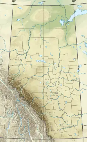 Terrapin Mountain Location in Alberta and British Columbia | |
| Location | Alberta British Columbia |
| Topo map | NTS 82J13 Mount Assiniboine |
| Climbing | |
| First ascent | 1915 H.O. Frind, L. Jeffers, Conrad Kain |
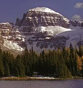
Terrapin Mountain is located on the border of Alberta and British Columbia on the Continental Divide. It was named in 1918.[1][2] A ridge extending north from the mountain terminates at Naiset Point.
Climate
Based on the Köppen climate classification, Terrapin Mountain is located in a subarctic climate with cold, snowy winters, and mild summers.[3] Temperatures can drop below −20 °C with wind chill factors below −30 °C.
See also
References
- 1 2 PeakFinder
- ↑ Terrapin Mountain
- ↑ Peel, M. C.; Finlayson, B. L.; McMahon, T. A. (2007). "Updated world map of the Köppen−Geiger climate classification". Hydrol. Earth Syst. Sci. 11: 1633–1644. ISSN 1027-5606.
External links
This article is issued from Wikipedia. The text is licensed under Creative Commons - Attribution - Sharealike. Additional terms may apply for the media files.