| Tornado Mountain | |
|---|---|
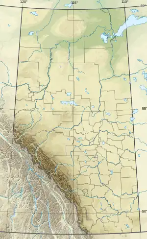 Tornado Mountain Location in Alberta and British Columbia 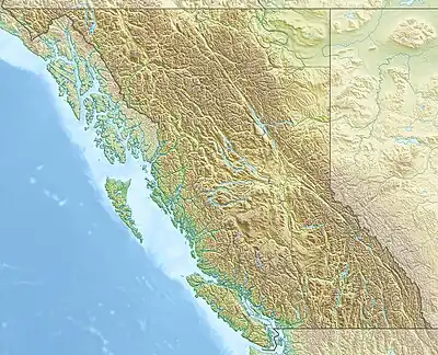 Tornado Mountain Tornado Mountain (British Columbia) | |
| Highest point | |
| Elevation | 3,099 m (10,167 ft)[1][2] |
| Prominence | 959 m (3,146 ft)[3] |
| Parent peak | Mount Rae (3218 m)[3] |
| Listing | |
| Coordinates | 49°58′01″N 114°39′16″W / 49.96694°N 114.65444°W[4] |
| Geography | |
| Country | Canada |
| Provinces | Alberta and British Columbia |
| Parent range | High Rock Range |
| Topo map | NTS 82G15 Tornado Mountain[4] |
| Climbing | |
| First ascent | 1915 Interprovincial Boundary Commission[3] |
Tornado Mountain is located on the border of Alberta and British Columbia on the Continental Divide.[5] It is Alberta's 48th most prominent mountain. It was named in 1915 by Morrison P. Bridgland.[1][3]
See also
References
- 1 2 "Tornado Mountain". cdnrockiesdatabases.ca. Retrieved 2012-05-11.
- ↑ "Topographic map of Tornado Mountain". opentopomap.org. Retrieved 2021-11-17.
- 1 2 3 4 "Tornado Mountain". Bivouac.com. Retrieved 2012-05-11.
- 1 2 "Tornado Mountain (Alberta)". Geographical Names Data Base. Natural Resources Canada. Retrieved 2021-11-17.
- ↑ "Tornado Mountain". BC Geographical Names. Retrieved 2021-11-17.
This article is issued from Wikipedia. The text is licensed under Creative Commons - Attribution - Sharealike. Additional terms may apply for the media files.