Urânia | |
|---|---|
Municipality | |
| The Municipality of Urânia | |
 Flag  Seal | |
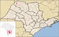 Location of Urânia | |
 Urânia | |
| Coordinates: 20°14′45″S 50°38′34″W / 20.24583°S 50.64278°W | |
| Country | |
| Region | Southeast |
| State | |
| Area | |
| • Total | 208.9 km2 (80.7 sq mi) |
| Elevation | 458 m (1,503 ft) |
| Population (2020 [1]) | |
| • Total | 9,120 |
| • Density | 42.2/km2 (109/sq mi) |
| Time zone | UTC−3 (BRT) |
| Postal Code | 15760-000 |
| Area code | +55 17 |
| Website | Prefecture of Urânia |
Urânia is a municipality in the state of São Paulo, Brazil. The city has a population of 9,120 inhabitants and an area of 208.9 km².[2]
Urânia belongs to the Mesoregion of São José do Rio Preto.
References
- ↑ IBGE 2020
- ↑ "2010 Census of the IBGE - Population - Table 2.1.20" (PDF) (in Portuguese). IBGE.gov.br. Retrieved 9 June 2012.
This article is issued from Wikipedia. The text is licensed under Creative Commons - Attribution - Sharealike. Additional terms may apply for the media files.