Varászló | |
|---|---|
Village | |
 Varászló Location of Varászló | |
| Coordinates: 46°26′06″N 17°12′57″E / 46.435089°N 17.215961°E | |
| Country | |
| Region | Southern Transdanubia |
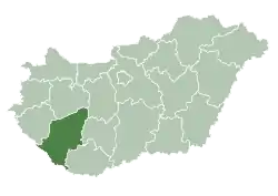
| County | Somogy |
| District | Marcali |
| RC Diocese | Kaposvár |
| Area | |
| • Total | 12.76 km2 (4.93 sq mi) |
| Population (2017) | |
| • Total | 142[1] |
| Demonym | varászlói |
| Time zone | UTC+1 (CET) |
| • Summer (DST) | UTC+2 (CEST) |
| Postal code | 8723 |
| Area code | (+36) 85 |
| NUTS 3 code | HU232 |
| MP | József Attila Móring (KDNP) |
External links
References

This article is issued from Wikipedia. The text is licensed under Creative Commons - Attribution - Sharealike. Additional terms may apply for the media files.