Wallendorf (Eifel) | |
|---|---|
 | |
 Coat of arms | |
Location of Wallendorf (Eifel) within Eifelkreis Bitburg-Prüm district 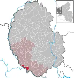 | |
 Wallendorf (Eifel) 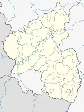 Wallendorf (Eifel) | |
| Coordinates: 49°52′46″N 6°17′22″E / 49.87944°N 6.28944°E | |
| Country | Germany |
| State | Rhineland-Palatinate |
| District | Eifelkreis Bitburg-Prüm |
| Municipal assoc. | Südeifel |
| Government | |
| • Mayor (2019–24) | Dieter Herschbach[1] |
| Area | |
| • Total | 8.71 km2 (3.36 sq mi) |
| Elevation | 180 m (590 ft) |
| Population (2021-12-31)[2] | |
| • Total | 207 |
| • Density | 24/km2 (62/sq mi) |
| Time zone | UTC+01:00 (CET) |
| • Summer (DST) | UTC+02:00 (CEST) |
| Postal codes | 54675 |
| Dialling codes | 06566 |
| Vehicle registration | BIT |
| Website | Wallendorf at site www.suedeifelinfo.de |
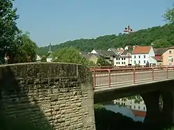
Wallendorf (Eifel) is a municipality in the German state of Rhineland-Palatinate, on the Sauer river.
Wallendorf was first mentioned in an old document from 1136 as "Vualcheresdorf". It is located on the German side of a bridge connecting it to the Luxembourgish town of Wallendorf-Pont. The bridge was of strategic importance during the Battle of the Bulge in World War II.
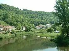
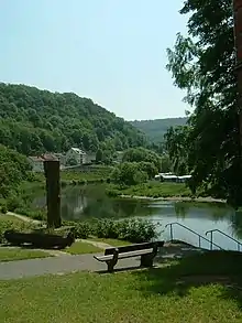
View to the Sauer-River
Genoveva-Fountain on the bank
References
- ↑ Direktwahlen 2019, Eifelkreis Bitburg-Prüm, Landeswahlleiter Rheinland-Pfalz, accessed 6 August 2021.
- ↑ "Bevölkerungsstand 2021, Kreise, Gemeinden, Verbandsgemeinden" (in German). Statistisches Landesamt Rheinland-Pfalz. 2022.
This article is issued from Wikipedia. The text is licensed under Creative Commons - Attribution - Sharealike. Additional terms may apply for the media files.