Ambatonikonilahy | |
|---|---|
 Ambatonikonilahy Location in Madagascar | |
| Coordinates: 19°43′S 46°56′E / 19.717°S 46.933°E | |
| Country | |
| Region | Vakinankaratra |
| District | Betafo |
| Elevation | 2,024 m (6,640 ft) |
| Population (2018)[2] | |
| • Total | 26,000 |
| • Ethnicities | Merina |
| Time zone | UTC3 (EAT) |
| Postal code | 113 |
Ambatonikonilahy is a rural municipality in Madagascar. It belongs to the district of Betafo, which is a part of Vakinankaratra Region. The population of this municipality was estimated to be approximately 26,000 in 2018.[2]
Only primary schooling is available. The majority 85% of the population of the commune are farmers, while an additional 15% receives their livelihood from raising livestock. The most important crops are potatoes and fruits, while other important agricultural products are vegetables, maize and sweet potatoes.[2]
Geography
The municipality is situated at 14.5 km North of Betafo and 39 km from Antsirabe.
Electricity
Ambatonikonilahy is presently not connected to an electric grid. 70% of its population gets light from petrol lamps and 10% from candles.[3] The remaining 20% stay in the dark.
References
- ↑ Estimated based on DEM data from Shuttle Radar Topography Mission
- 1 2 3 "ILO census data". Cornell University. 2002. Retrieved 2008-04-22.
- ↑ Café Lumiere
Capital: Antsirabe | ||
| Ambatolampy (19) | 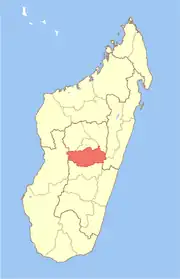 | |
| Antanifotsy (14) | ||
| Antsirabe I (1) | ||
| Antsirabe II (20) | ||
| Betafo (18) | ||
| Faratsiho (9) | ||
| Mandoto (9) | ||
7 districts; 89 communes | ||
19°43′S 46°56′E / 19.717°S 46.933°E