Antsotso | |
|---|---|
 Antsotso Location in Madagascar | |
| Coordinates: 19°49′S 46°52′E / 19.817°S 46.867°E | |
| Country | |
| Region | Vakinankaratra |
| District | Betafo |
| Elevation | 1,480 m (4,860 ft) |
| Population (2001)[2] | |
| • Total | 15,000 |
| • Ethnicities | Merina |
| Time zone | UTC3 (EAT) |
| Postal code | 113 |
Antsotso or Antsoso is a rural municipality in Madagascar. It belongs to the district of Betafo, which is a part of Vakinankaratra Region. The population of the commune was estimated to be approximately 15,000 in 2001 commune census.[2]
Only primary schooling is available. The majority 92% of the population of the commune are farmers, while an additional 8% receives their livelihood from raising livestock. The most important crop is rice, while other important products are maize, potatoes and soya.[2]
Geography
The town lies at the river Landratsay and north from Betafo.
References and notes
- ↑ Estimated based on DEM data from Shuttle Radar Topography Mission
- 1 2 3 "ILO census data". Cornell University. 2002. Retrieved 2008-04-22.
Capital: Antsirabe | ||
| Ambatolampy (19) | 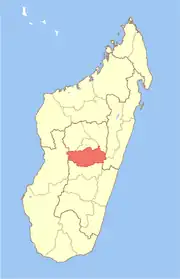 | |
| Antanifotsy (14) | ||
| Antsirabe I (1) | ||
| Antsirabe II (20) | ||
| Betafo (18) | ||
| Faratsiho (9) | ||
| Mandoto (9) | ||
7 districts; 89 communes | ||
19°49′S 46°52′E / 19.817°S 46.867°E
This article is issued from Wikipedia. The text is licensed under Creative Commons - Attribution - Sharealike. Additional terms may apply for the media files.