Ambatovola Gara | |
|---|---|
 Ambatovola Gara Location in Madagascar | |
| Coordinates: 18°53′S 48°34′E / 18.883°S 48.567°E | |
| Country | |
| Region | Alaotra-Mangoro |
| District | Moramanga |
| Elevation | 663 m (2,175 ft) |
| Population (2018)[2] | |
| • Total | 7,339 |
| Time zone | UTC3 (EAT) |
| Postal code | 514 |
| Climate | Cfa |
Ambatovola (also known as Ambatovola Gara) is a rural municipality in Madagascar. It belongs to the district of Moramanga, which is a part of Alaotra-Mangoro Region. The population of the commune was 7,339 in a 2018.
The town provides a primary and junior level of education, and 99% of the population of the commune are farmers.
Rice, bananas, coffee and ginger are some of the town's most important crops. Services provide employment for 1% of the population.[3]
Nature
A part of the Andasibe-Mantadia National Park is situated in this municipality. It is situated at the Sanatanora river.[4]
References
- ↑ Estimated based on DEM data from Shuttle Radar Topography Mission
- ↑ TROISIEME RECENSEMENT GENERAL DE LA POPULATION ET DE L’HABITATION
- ↑ "ILO census data". Cornell University. 2002. Retrieved 2008-03-24.
- ↑ worldbank.org
Capital: Ambatondrazaka | ||
| Ambatondrazaka (21) | 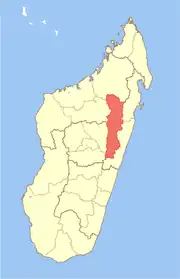 | |
| Amparafaravola (21) | ||
| Andilamena (8) | ||
| Anosibe An'ala (11) | ||
| Moramanga (22) | ||
5 districts; 82 communes | ||
18°53′S 48°34′E / 18.883°S 48.567°E
This article is issued from Wikipedia. The text is licensed under Creative Commons - Attribution - Sharealike. Additional terms may apply for the media files.