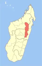
Sahamamy | |
|---|---|
 Sahamamy Location in Madagascar | |
| Coordinates: 17°31′S 48°18′E / 17.517°S 48.300°E | |
| Country | |
| Region | Alaotra-Mangoro |
| District | Amparafaravola |
| Population | |
| • Total | 4,000 |
| Time zone | UTC3 (EAT) |
| Postal code | 504 |
Sahamamy is a rural municipality in Madagascar. It belongs to the district of Amparafaravola, which is a part of Alaotra-Mangoro Region. The population of the commune is not known, but in 2013 elections there had been 3942 authorized voters.[1]
Geography
This municipality is situated at 15 km North of Amparafaravola. 4 fokontany (villages) belong to this municipality.
Infrastructures
The National Road 3a crosses this municipality.
References
This article is issued from Wikipedia. The text is licensed under Creative Commons - Attribution - Sharealike. Additional terms may apply for the media files.
