Mandialaza | |
|---|---|
 Mandialaza Location in Madagascar | |
| Coordinates: 18°37′S 48°2′E / 18.617°S 48.033°E | |
| Country | |
| Region | Alaotra-Mangoro |
| District | Moramanga |
| Elevation | 900 m (3,000 ft) |
| Population (2018) | |
| • Total | 15,835 |
| Time zone | UTC3 (EAT) |
| Postal code | 514 |
Mandialaza is a rural municipality in Madagascar. It belongs to the district of Moramanga, which is a part of Alaotra-Mangoro Region. The population of the municipality was 15835 in 2018.
Primary and junior level secondary education are available in town. The majority 93% of the population of the commune are farmers. The most important crop is rice, while other important products are bananas, beans and cassava. Services provide employment for 7% of the population.[2]
Rivers
The Mangoro River has its sources in Mandialaza, about 14km North-East of the village.[3]
References
- ↑ Estimated based on DEM data from Shuttle Radar Topography Mission
- ↑ "ILO census data". Cornell University. 2002. Retrieved 2008-03-24.
- ↑ Mangoro
Capital: Ambatondrazaka | ||
| Ambatondrazaka (21) | 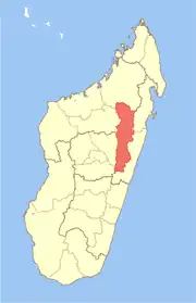 | |
| Amparafaravola (21) | ||
| Andilamena (8) | ||
| Anosibe An'ala (11) | ||
| Moramanga (22) | ||
5 districts; 82 communes | ||
18°37′S 48°2′E / 18.617°S 48.033°E
This article is issued from Wikipedia. The text is licensed under Creative Commons - Attribution - Sharealike. Additional terms may apply for the media files.