Bácsborsód | |
|---|---|
 Coat of arms | |
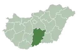
 Bácsborsód Location of Bácsborsód in Hungary | |
| Coordinates: 46°05′39″N 19°09′32″E / 46.09430°N 19.15902°E | |
| Country | Hungary |
| Region | Southern Great Plain |
| County | Bács-Kiskun |
| Subregion | Bajai |
| Rank | Village |
| Area | |
| • Total | 77.52 km2 (29.93 sq mi) |
| Population (1 January 2008)[2] | |
| • Total | 1,245 |
| • Density | 16/km2 (42/sq mi) |
| Time zone | UTC+1 (CET) |
| • Summer (DST) | UTC+2 (CEST) |
| Postal code | 6454 |
| Area code | +36 79 |
| KSH code | 27234[1] |
| Website | www.bacsborsod.hu |
Bácsborsód is a large village and municipality in Bács-Kiskun county, in the Southern Great Plain region of southern Hungary. Until 1941, a small community of Jews lived in the village. After the Holocaust of the Hungarian Jews there were no Jews left in the village.[3]
Geography
It covers an area of 72.52 km2 and has a population of 1287 people.
References
- 1 2 Bácsborsód at the Hungarian Central Statistical Office (Hungarian).
- ↑ Bácsborsód at the Hungarian Central Statistical Office (Hungarian). 1 January 2008
- ↑ Census of Hungarian Jews
46°06′N 19°09′E / 46.100°N 19.150°E
This article is issued from Wikipedia. The text is licensed under Creative Commons - Attribution - Sharealike. Additional terms may apply for the media files.