Pálmonostora | |
|---|---|
| Country | |
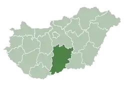
| County | Bács-Kiskun |
| Area | |
| • Total | 53.29 km2 (20.58 sq mi) |
| Population (2015) | |
| • Total | 1,801[1] |
| • Density | 33.8/km2 (88/sq mi) |
| Time zone | UTC+1 (CET) |
| • Summer (DST) | UTC+2 (CEST) |
| Postal code | 6112 |
| Area code | 76 |
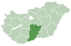
Location of Bács-Kiskun
county in Hungary
Pálmonostora is a village in Bács-Kiskun county, in the Southern Great Plain region of southern Hungary.
Geography
It covers an area of 53.29 km2 (21 sq mi) and has a population of 1801 people (2015).[1]
References
- 1 2 Gazetteer of Hungary, 1 January 2015. Hungarian Central Statistical Office. 3 September 2015

46°38′N 19°57′E / 46.633°N 19.950°E
This article is issued from Wikipedia. The text is licensed under Creative Commons - Attribution - Sharealike. Additional terms may apply for the media files.