Bans | |
|---|---|
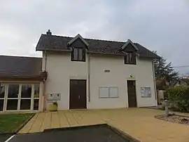 The town hall in Bans | |
Location of Bans | |
 Bans  Bans | |
| Coordinates: 46°58′56″N 5°34′55″E / 46.9822°N 5.5819°E | |
| Country | France |
| Region | Bourgogne-Franche-Comté |
| Department | Jura |
| Arrondissement | Dole |
| Canton | Mont-sous-Vaudrey |
| Government | |
| • Mayor (2020–2026) | Stéphanie Desarbres[1] |
| Area 1 | 3.92 km2 (1.51 sq mi) |
| Population | 188 |
| • Density | 48/km2 (120/sq mi) |
| Time zone | UTC+01:00 (CET) |
| • Summer (DST) | UTC+02:00 (CEST) |
| INSEE/Postal code | 39037 /39380 |
| Elevation | 209–246 m (686–807 ft) |
| 1 French Land Register data, which excludes lakes, ponds, glaciers > 1 km2 (0.386 sq mi or 247 acres) and river estuaries. | |
Bans is a commune in the Jura department in the region of Bourgogne-Franche-Comté in eastern France.[3]
Population
| Year | Pop. | ±% p.a. |
|---|---|---|
| 1968 | 118 | — |
| 1975 | 111 | −0.87% |
| 1982 | 119 | +1.00% |
| 1990 | 140 | +2.05% |
| 1999 | 141 | +0.08% |
| 2009 | 198 | +3.45% |
| 2014 | 187 | −1.14% |
| 2020 | 194 | +0.61% |
| Source: INSEE[4] | ||
See also
References
- ↑ "Répertoire national des élus: les maires". data.gouv.fr, Plateforme ouverte des données publiques françaises (in French). 9 August 2021.
- ↑ "Populations légales 2021". The National Institute of Statistics and Economic Studies. 28 December 2023.
- ↑ INSEE commune file
- ↑ Population en historique depuis 1968, INSEE
Wikimedia Commons has media related to Bans.
This article is issued from Wikipedia. The text is licensed under Creative Commons - Attribution - Sharealike. Additional terms may apply for the media files.