Coyrière | |
|---|---|
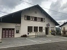 The town hall in Coyrière | |
Location of Coyrière | |
 Coyrière  Coyrière | |
| Coordinates: 46°20′37″N 5°50′39″E / 46.3436°N 5.8442°E | |
| Country | France |
| Region | Bourgogne-Franche-Comté |
| Department | Jura |
| Arrondissement | Saint-Claude |
| Canton | Coteaux du Lizon |
| Government | |
| • Mayor (2020–2026) | Daniel Grenard[1] |
| Area 1 | 4.11 km2 (1.59 sq mi) |
| Population | 65 |
| • Density | 16/km2 (41/sq mi) |
| Time zone | UTC+01:00 (CET) |
| • Summer (DST) | UTC+02:00 (CEST) |
| INSEE/Postal code | 39174 /39200 |
| Elevation | 520–1,125 m (1,706–3,691 ft) |
| 1 French Land Register data, which excludes lakes, ponds, glaciers > 1 km2 (0.386 sq mi or 247 acres) and river estuaries. | |
Coyrière (French pronunciation: [kwaʁjɛʁ]) is a commune in the Jura department in Bourgogne-Franche-Comté in eastern France.[3]
Population
| Year | Pop. | ±% p.a. |
|---|---|---|
| 1968 | 50 | — |
| 1975 | 40 | −3.14% |
| 1982 | 48 | +2.64% |
| 1990 | 74 | +5.56% |
| 1999 | 74 | +0.00% |
| 2009 | 64 | −1.44% |
| 2014 | 66 | +0.62% |
| 2020 | 65 | −0.25% |
| Source: INSEE[4] | ||
See also
References
- ↑ "Répertoire national des élus: les maires". data.gouv.fr, Plateforme ouverte des données publiques françaises (in French). 2 December 2020.
- ↑ "Populations légales 2021". The National Institute of Statistics and Economic Studies. 28 December 2023.
- ↑ INSEE commune file
- ↑ Population en historique depuis 1968, INSEE
Wikimedia Commons has media related to Coyrière.
This article is issued from Wikipedia. The text is licensed under Creative Commons - Attribution - Sharealike. Additional terms may apply for the media files.