Rans | |
|---|---|
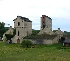 Old forge | |
.svg.png.webp) Coat of arms | |
Location of Rans | |
 Rans  Rans | |
| Coordinates: 47°08′29″N 5°43′39″E / 47.1414°N 5.7275°E | |
| Country | France |
| Region | Bourgogne-Franche-Comté |
| Department | Jura |
| Arrondissement | Dole |
| Canton | Mont-sous-Vaudrey |
| Government | |
| • Mayor (2020–2026) | Jean-Louis Morlier[1] |
| Area 1 | 6.14 km2 (2.37 sq mi) |
| Population | 529 |
| • Density | 86/km2 (220/sq mi) |
| Time zone | UTC+01:00 (CET) |
| • Summer (DST) | UTC+02:00 (CEST) |
| INSEE/Postal code | 39452 /39700 |
| Elevation | 209–269 m (686–883 ft) |
| 1 French Land Register data, which excludes lakes, ponds, glaciers > 1 km2 (0.386 sq mi or 247 acres) and river estuaries. | |
Rans is a commune in the Jura department in the region of Bourgogne-Franche-Comté in eastern France.[3]
Population
| Year | Pop. | ±% p.a. |
|---|---|---|
| 1968 | 350 | — |
| 1975 | 402 | +2.00% |
| 1982 | 404 | +0.07% |
| 1990 | 389 | −0.47% |
| 1999 | 416 | +0.75% |
| 2009 | 468 | +1.18% |
| 2014 | 524 | +2.29% |
| 2020 | 527 | +0.10% |
| Source: INSEE[4] | ||
See also
References
- ↑ "Répertoire national des élus: les maires". data.gouv.fr, Plateforme ouverte des données publiques françaises (in French). 9 August 2021.
- ↑ "Populations légales 2021". The National Institute of Statistics and Economic Studies. 28 December 2023.
- ↑ INSEE commune file
- ↑ Population en historique depuis 1968, INSEE
Wikimedia Commons has media related to Rans.
This article is issued from Wikipedia. The text is licensed under Creative Commons - Attribution - Sharealike. Additional terms may apply for the media files.