Berg
Bärich | |
|---|---|
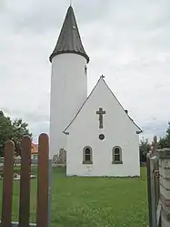 The church in Berg | |
 Coat of arms | |
Location of Berg | |
 Berg  Berg | |
| Coordinates: 48°53′53″N 7°09′25″E / 48.8981°N 7.1569°E | |
| Country | France |
| Region | Grand Est |
| Department | Bas-Rhin |
| Arrondissement | Saverne |
| Canton | Ingwiller |
| Government | |
| • Mayor (2020–2026) | Jean-Pierre Nickles[1] |
| Area 1 | 7.72 km2 (2.98 sq mi) |
| Population | 349 |
| • Density | 45/km2 (120/sq mi) |
| Time zone | UTC+01:00 (CET) |
| • Summer (DST) | UTC+02:00 (CEST) |
| INSEE/Postal code | 67029 /67320 |
| Elevation | 240–359 m (787–1,178 ft) |
| 1 French Land Register data, which excludes lakes, ponds, glaciers > 1 km2 (0.386 sq mi or 247 acres) and river estuaries. | |
Berg (French pronunciation: [bɛʁg] ⓘ) is a commune in the Bas-Rhin department in Grand Est in northeastern France.[3]
Population
| Year | Pop. | ±% p.a. |
|---|---|---|
| 1968 | 411 | — |
| 1975 | 410 | −0.03% |
| 1982 | 436 | +0.88% |
| 1990 | 428 | −0.23% |
| 1999 | 405 | −0.61% |
| 2009 | 417 | +0.29% |
| 2014 | 381 | −1.79% |
| 2020 | 352 | −1.31% |
| Source: INSEE[4] | ||
See also
References
- ↑ "Répertoire national des élus: les maires". data.gouv.fr, Plateforme ouverte des données publiques françaises (in French). 2 December 2020.
- ↑ "Populations légales 2021". The National Institute of Statistics and Economic Studies. 28 December 2023.
- ↑ INSEE commune file
- ↑ Population en historique depuis 1968, INSEE
Wikimedia Commons has media related to Berg (Bas-Rhin).
This article is issued from Wikipedia. The text is licensed under Creative Commons - Attribution - Sharealike. Additional terms may apply for the media files.