Ohlungen
Ohlunge | |
|---|---|
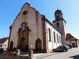 The church in Ohlungen | |
 Coat of arms | |
Location of Ohlungen | |
 Ohlungen  Ohlungen | |
| Coordinates: 48°48′43″N 7°42′06″E / 48.8119°N 7.7017°E | |
| Country | France |
| Region | Grand Est |
| Department | Bas-Rhin |
| Arrondissement | Haguenau-Wissembourg |
| Canton | Haguenau |
| Intercommunality | CA Haguenau |
| Government | |
| • Mayor (2020–2026) | Daniel Klieber[1] |
| Area 1 | 8.39 km2 (3.24 sq mi) |
| Population | 1,343 |
| • Density | 160/km2 (410/sq mi) |
| Time zone | UTC+01:00 (CET) |
| • Summer (DST) | UTC+02:00 (CEST) |
| INSEE/Postal code | 67359 /67590 |
| Elevation | 152–236 m (499–774 ft) |
| 1 French Land Register data, which excludes lakes, ponds, glaciers > 1 km2 (0.386 sq mi or 247 acres) and river estuaries. | |
Ohlungen (French pronunciation: [oluŋ(ɡ)ən]) is a commune in the Bas-Rhin department in Grand Est in north-eastern France.[3]
History
Ohlungen was an Imperial Village (Reichsdorf) of the Holy Roman Empire. Within its jurisdiction was a former Imperial Hamlet (Reichsweiler) called Keffendorf. Both passed to France in the Peace of Westphalia in 1648. In November 1944, German occupiers expelled around 10% of the village population in anticipation of severe fighting in the area.
See also
References
- ↑ "Répertoire national des élus: les maires". data.gouv.fr, Plateforme ouverte des données publiques françaises (in French). 2 December 2020.
- ↑ "Populations légales 2021". The National Institute of Statistics and Economic Studies. 28 December 2023.
- ↑ INSEE commune file
Wikimedia Commons has media related to Ohlungen.
This article is issued from Wikipedia. The text is licensed under Creative Commons - Attribution - Sharealike. Additional terms may apply for the media files.