Niederhausbergen
| |
|---|---|
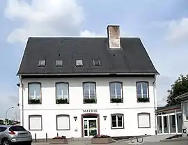 The town hall in Niederhausbergen | |
.svg.png.webp) Coat of arms | |
Location of Niederhausbergen | |
 Niederhausbergen  Niederhausbergen | |
| Coordinates: 48°37′30″N 7°42′17″E / 48.625°N 7.7047°E | |
| Country | France |
| Region | Grand Est |
| Department | Bas-Rhin |
| Arrondissement | Strasbourg |
| Canton | Hœnheim |
| Intercommunality | Strasbourg Eurométropole |
| Government | |
| • Mayor (2020–2026) | Jean-Luc Herzog[1] |
| Area 1 | 3.06 km2 (1.18 sq mi) |
| Population | 1,673 |
| • Density | 550/km2 (1,400/sq mi) |
| Time zone | UTC+01:00 (CET) |
| • Summer (DST) | UTC+02:00 (CEST) |
| INSEE/Postal code | 67326 /67207 |
| Elevation | 141–191 m (463–627 ft) |
| 1 French Land Register data, which excludes lakes, ponds, glaciers > 1 km2 (0.386 sq mi or 247 acres) and river estuaries. | |
Niederhausbergen (Alsatian: Nìderhüsbarje) is a commune in the Bas-Rhin department in Grand Est in north-eastern France.[3]
Niederhausbergen is a small residential area on the outskirts of Strasbourg, located 6 km northwest of the latter. It adjoins the hill Hausbergen, which represents the foothills of the Vosges du Nord region Kochersberg.
See also
References
- ↑ "Répertoire national des élus: les maires" (in French). data.gouv.fr, Plateforme ouverte des données publiques françaises. 13 September 2022.
- ↑ "Populations légales 2021". The National Institute of Statistics and Economic Studies. 28 December 2023.
- ↑ INSEE commune file
Wikimedia Commons has media related to Niederhausbergen.
This article is issued from Wikipedia. The text is licensed under Creative Commons - Attribution - Sharealike. Additional terms may apply for the media files.