Crépey | |
|---|---|
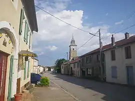 A view within Crépey | |
.svg.png.webp) Coat of arms | |
Location of Crépey | |
 Crépey  Crépey | |
| Coordinates: 48°31′43″N 5°58′20″E / 48.5286°N 5.9722°E | |
| Country | France |
| Region | Grand Est |
| Department | Meurthe-et-Moselle |
| Arrondissement | Toul |
| Canton | Meine au Saintois |
| Intercommunality | CC Pays de Colombey et Sud Toulois |
| Government | |
| • Mayor (2020–2026) | Daniel Thomassin[1] |
| Area 1 | 20.9 km2 (8.1 sq mi) |
| Population | 384 |
| • Density | 18/km2 (48/sq mi) |
| Time zone | UTC+01:00 (CET) |
| • Summer (DST) | UTC+02:00 (CEST) |
| INSEE/Postal code | 54143 /54170 |
| Elevation | 297–434 m (974–1,424 ft) |
| 1 French Land Register data, which excludes lakes, ponds, glaciers > 1 km2 (0.386 sq mi or 247 acres) and river estuaries. | |
Crépey (French pronunciation: [kʁepɛ]) is a commune in the Meurthe-et-Moselle department in north-eastern France.[3]
The altitude of the commune of Crépey ranges between 297 and 434 meters. The area of the commune is 20.90 km2.[4]
Population and Housing
Crépey had a population of 391 in 2019.[5] As of 2019, there are 176 dwellings in the commune, of which 157 primary residences.[6]
See also
References
- ↑ "Répertoire national des élus: les maires". data.gouv.fr, Plateforme ouverte des données publiques françaises (in French). 9 August 2021.
- ↑ "Populations légales 2021". The National Institute of Statistics and Economic Studies. 28 December 2023.
- ↑ Commune de Crépey (54143), INSEE
- ↑ Des villages de Cassini aux communes d'aujourd'hui: Commune data sheet Crépey, EHESS (in French).
- ↑ Populations légales 2019: 54 Meurthe-et-Moselle, INSEE
- ↑ Logement en 2019, Commune de Crépey (54143), INSEE
Wikimedia Commons has media related to Crépey.
This article is issued from Wikipedia. The text is licensed under Creative Commons - Attribution - Sharealike. Additional terms may apply for the media files.