Dolní Bojanovice | |
|---|---|
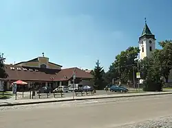 Square with Church of Saint Wenceslaus | |
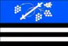 Flag  Coat of arms | |
 Dolní Bojanovice Location in the Czech Republic | |
| Coordinates: 48°51′31″N 17°1′43″E / 48.85861°N 17.02861°E | |
| Country | |
| Region | South Moravian |
| District | Hodonín |
| First mentioned | 1196 |
| Area | |
| • Total | 19.91 km2 (7.69 sq mi) |
| Elevation | 178 m (584 ft) |
| Population (2023-01-01)[1] | |
| • Total | 3,035 |
| • Density | 150/km2 (390/sq mi) |
| Time zone | UTC+1 (CET) |
| • Summer (DST) | UTC+2 (CEST) |
| Postal code | 696 17 |
| Website | www |
Dolní Bojanovice (German: Unter Bojanowitz) is a municipality and village in Hodonín District in the South Moravian Region of the Czech Republic. It has about 3,000 inhabitants.
Dolní Bojanovice lies approximately 8 kilometres (5 mi) west of Hodonín, 49 km (30 mi) south-east of Brno, and 233 km (145 mi) south-east of Prague.
History
The first written mention of Dolní Bojanovice is from 1196.[2]
Notable people
- Petr Esterka (1935–2021), Czech-American bishop
References
- ↑ "Population of Municipalities – 1 January 2023". Czech Statistical Office. 2023-05-23.
- ↑ "Historie obce" (in Czech). Obec Dolní Bojanovice. Retrieved 2021-08-20.
Wikimedia Commons has media related to Dolní Bojanovice.
This article is issued from Wikipedia. The text is licensed under Creative Commons - Attribution - Sharealike. Additional terms may apply for the media files.