Höflein an der Hohen Wand | |
|---|---|
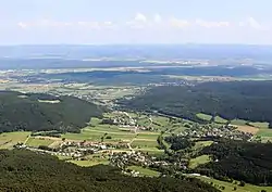 View from Hohen Wand | |
 Coat of arms | |
 Höflein an der Hohen Wand Location within Austria | |
| Coordinates: 47°47′N 16°1′E / 47.783°N 16.017°E | |
| Country | Austria |
| State | Lower Austria |
| District | Neunkirchen |
| Government | |
| • Mayor | Günther Stickler |
| Area | |
| • Total | 8.94 km2 (3.45 sq mi) |
| Elevation | 490 m (1,610 ft) |
| Population (2018-01-01)[2] | |
| • Total | 895 |
| • Density | 100/km2 (260/sq mi) |
| Time zone | UTC+1 (CET) |
| • Summer (DST) | UTC+2 (CEST) |
| Postal code | 2732 |
| Area code | 02620 |
| Website | www.hoeflein.com |
Höflein an der Hohen Wand is a town in the district of Neunkirchen in the Austrian state of Lower Austria.
Population
| Year | Pop. | ±% |
|---|---|---|
| 1869 | 452 | — |
| 1880 | 485 | +7.3% |
| 1890 | 545 | +12.4% |
| 1900 | 605 | +11.0% |
| 1910 | 694 | +14.7% |
| 1923 | 804 | +15.9% |
| 1934 | 792 | −1.5% |
| 1939 | 771 | −2.7% |
| 1951 | 724 | −6.1% |
| 1961 | 703 | −2.9% |
| 1971 | 769 | +9.4% |
| 1981 | 743 | −3.4% |
| 1991 | 717 | −3.5% |
| 2001 | 779 | +8.6% |
| 2011 | 868 | +11.4% |
References
- ↑ "Dauersiedlungsraum der Gemeinden Politischen Bezirke und Bundesländer - Gebietsstand 1.1.2018". Statistics Austria. Retrieved 10 March 2019.
- ↑ "Einwohnerzahl 1.1.2018 nach Gemeinden mit Status, Gebietsstand 1.1.2018". Statistics Austria. Retrieved 9 March 2019.
This article is issued from Wikipedia. The text is licensed under Creative Commons - Attribution - Sharealike. Additional terms may apply for the media files.