Wartmannstetten | |
|---|---|
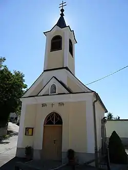 Chapel in Rampach (part of Wartmannstetten) | |
 Coat of arms | |
 Wartmannstetten Location within Austria | |
| Coordinates: 47°41′N 16°4′E / 47.683°N 16.067°E | |
| Country | Austria |
| State | Lower Austria |
| District | Neunkirchen |
| Government | |
| • Mayor | Franz Hubinger |
| Area | |
| • Total | 21.41 km2 (8.27 sq mi) |
| Elevation | 419 m (1,375 ft) |
| Population (2018-01-01)[2] | |
| • Total | 1,605 |
| • Density | 75/km2 (190/sq mi) |
| Time zone | UTC+1 (CET) |
| • Summer (DST) | UTC+2 (CEST) |
| Postal code | 2620 |
| Area code | 02635 |
| Website | www.wartmannstetten.gv.at |
Wartmannstetten is a town in the district of Neunkirchen in the Austrian state of Lower Austria.
Population
| Year | Pop. | ±% |
|---|---|---|
| 1880 | 1,241 | — |
| 1890 | 1,405 | +13.2% |
| 1900 | 1,419 | +1.0% |
| 1910 | 1,489 | +4.9% |
| 1923 | 1,439 | −3.4% |
| 1934 | 1,363 | −5.3% |
| 1939 | 1,305 | −4.3% |
| 1951 | 1,224 | −6.2% |
| 1961 | 1,168 | −4.6% |
| 1971 | 1,241 | +6.2% |
| 1981 | 1,271 | +2.4% |
| 1991 | 1,426 | +12.2% |
| 2001 | 1,675 | +17.5% |
| 2011 | 1,606 | −4.1% |
References
- ↑ "Dauersiedlungsraum der Gemeinden Politischen Bezirke und Bundesländer - Gebietsstand 1.1.2018". Statistics Austria. Retrieved 10 March 2019.
- ↑ "Einwohnerzahl 1.1.2018 nach Gemeinden mit Status, Gebietsstand 1.1.2018". Statistics Austria. Retrieved 9 March 2019.
This article is issued from Wikipedia. The text is licensed under Creative Commons - Attribution - Sharealike. Additional terms may apply for the media files.