 | ||||
|---|---|---|---|---|
| Автошлях М21 | ||||
 | ||||
| Route information | ||||
| Part of | ||||
| Length | 401.7 km (249.6 mi) | |||
| Major junctions | ||||
| North end | Belarusian border at Vistusovichi checkpoint | |||
| South end | Moldovan border at Mohyliv-Podilskyi (thru Otaci) | |||
| Location | ||||
| Country | Ukraine | |||
| Oblasts | Zhytomyr, Vinnytsia | |||
| Highway system | ||||
| ||||
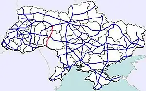
M21 is a Ukrainian international highway (M-highway) which connects Zhytomyr and Vinnytsia to the border with Moldova.[1] The highway also connects two major transnational corridors, Pan-European Corridor IX and the transportation corridor "Europe-Asia". The entire route is part of European route E583.[2] The section from Zhytomyr to the Belarusian border was previously P28.
Route
| Marker | Main settlements | Notes | Highway Interchanges |
|---|---|---|---|
| 0 km | Zhytomyr | ||
| Vinnytsia | |||
| 220 km | Mohyliv-Podilskyi / Border (Moldova) | Border checkpoint |
See also
References
External links
- International Roads in Ukraine in Russian
- European Roads in Russian
| E-roads in Ukraine | ||
|---|---|---|
| International | ||
| National | ||
| Regional | ||
| ||
This article is issued from Wikipedia. The text is licensed under Creative Commons - Attribution - Sharealike. Additional terms may apply for the media files.