| Road P21 | ||||
|---|---|---|---|---|
| Автошлях Р21 | ||||
 | ||||
| Route information | ||||
| Length | 128.8 km (80.0 mi) | |||
| Major junctions | ||||
| north end | ||||
| south end | ||||
| Location | ||||
| Country | Ukraine | |||
| Oblasts | Zakarpattia, Ivano-Frankivsk Oblast | |||
| Highway system | ||||
| ||||
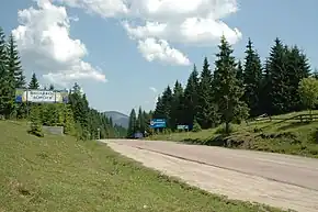
P21 road is a regional road (P-Highway) in Zakarpattia Oblast and Ivano-Frankivsk, Ukraine. It runs north-south and connects cities of Dolyna and Khust.[1]
Main route
Main route and connections to/intersections with other highways in Ukraine.[2]
| Marker | Main settlements | Notes | Highway Interchanges |
|---|---|---|---|
| Ivano-Frankivsk Oblast | |||
| 0 km | Dolyna | vulytsia Oblisky • | |
| Torun pass | |||
| Soimy | T0718 | ||
| Mizhhiria | T0720 | ||
| Lypcha | T0721 | ||
| 128.8 km | Khust | Lvivska vulytsia • | |
See also
References
External links
- Regional Roads in Ukraine in Russian
| E-roads in Ukraine | ||
|---|---|---|
| International | ||
| National | ||
| Regional | ||
| ||
Roads in Zakarpattia Oblast | ||
|---|---|---|
| E-roads in Zakarpattia | ||
| International | ||
| National | ||
| Regional | ||
| Territorial |
| |
| ||
Roads in Ivano-Frankivsk Oblast | ||
|---|---|---|
| E-roads in Prykarpattia | ||
| International | ||
| National | ||
| Regional | ||
| Territorial |
| |
| ||
This article is issued from Wikipedia. The text is licensed under Creative Commons - Attribution - Sharealike. Additional terms may apply for the media files.