Hohenwarth-Mühlbach am Manhartsberg | |
|---|---|
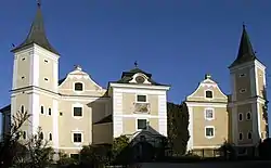 Mühlbach Castle | |
 Coat of arms | |
 Hohenwarth-Mühlbach am Manhartsberg Location within Austria | |
| Coordinates: 48°30′N 15°49′E / 48.500°N 15.817°E | |
| Country | Austria |
| State | Lower Austria |
| District | Hollabrunn |
| Government | |
| • Mayor | Alfred Zeilinger |
| Area | |
| • Total | 43.59 km2 (16.83 sq mi) |
| Elevation | 365 m (1,198 ft) |
| Population (2018-01-01)[2] | |
| • Total | 1,304 |
| • Density | 30/km2 (77/sq mi) |
| Time zone | UTC+1 (CET) |
| • Summer (DST) | UTC+2 (CEST) |
| Postal code | 3472 |
| Area code | 02957 |
| Website | www.hohenwarth-muehlbach.at |
Hohenwarth-Mühlbach am Manhartsberg is a municipality in the district of Hollabrunn in Lower Austria, Austria.
Geography
Hohenwarth-Mühlbach lies in the Weinviertel in Lower Austria. About 29.87 percent of the municipality is forested. The Gießgraben has its source near Hohenwarth.
References
- ↑ "Dauersiedlungsraum der Gemeinden Politischen Bezirke und Bundesländer - Gebietsstand 1.1.2018". Statistics Austria. Retrieved 10 March 2019.
- ↑ "Einwohnerzahl 1.1.2018 nach Gemeinden mit Status, Gebietsstand 1.1.2018". Statistics Austria. Retrieved 9 March 2019.
This article is issued from Wikipedia. The text is licensed under Creative Commons - Attribution - Sharealike. Additional terms may apply for the media files.