Sitzendorf an der Schmida | |
|---|---|
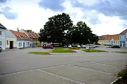 Main square | |
 Coat of arms | |
 Sitzendorf an der Schmida Location within Austria | |
| Coordinates: 48°36′N 15°56′E / 48.600°N 15.933°E | |
| Country | Austria |
| State | Lower Austria |
| District | Hollabrunn |
| Government | |
| • Mayor | Leopold Hummer |
| Area | |
| • Total | 61.85 km2 (23.88 sq mi) |
| Elevation | 244 m (801 ft) |
| Population (2018-01-01)[2] | |
| • Total | 2,162 |
| • Density | 35/km2 (91/sq mi) |
| Time zone | UTC+1 (CET) |
| • Summer (DST) | UTC+2 (CEST) |
| Postal code | 3714 |
| Area code | 02959 |
| Website | www.sitzendorf.at |
Sitzendorf an der Schmida is a town in the district of Hollabrunn in Lower Austria, Austria.
Geography
Sitzendorf an der Schmida lies on the Schmida River. About 6.59 percent of the municipality is forested.
References
- ↑ "Dauersiedlungsraum der Gemeinden Politischen Bezirke und Bundesländer - Gebietsstand 1.1.2018". Statistics Austria. Retrieved 10 March 2019.
- ↑ "Einwohnerzahl 1.1.2018 nach Gemeinden mit Status, Gebietsstand 1.1.2018". Statistics Austria. Retrieved 9 March 2019.
Wikimedia Commons has media related to Sitzendorf an der Schmida.
This article is issued from Wikipedia. The text is licensed under Creative Commons - Attribution - Sharealike. Additional terms may apply for the media files.