Issanlas | |
|---|---|
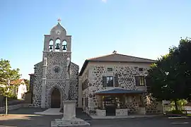 The church and town hall in Issanlas | |
Location of Issanlas | |
 Issanlas  Issanlas | |
| Coordinates: 44°45′57″N 4°00′44″E / 44.7658°N 4.0122°E | |
| Country | France |
| Region | Auvergne-Rhône-Alpes |
| Department | Ardèche |
| Arrondissement | Largentière |
| Canton | Haute-Ardèche |
| Government | |
| • Mayor (2020–2026) | John Serroul[1] |
| Area 1 | 28.4 km2 (11.0 sq mi) |
| Population | 102 |
| • Density | 3.6/km2 (9.3/sq mi) |
| Time zone | UTC+01:00 (CET) |
| • Summer (DST) | UTC+02:00 (CEST) |
| INSEE/Postal code | 07105 /07510 |
| Elevation | 1,119–1,374 m (3,671–4,508 ft) (avg. 1,180 m or 3,870 ft) |
| 1 French Land Register data, which excludes lakes, ponds, glaciers > 1 km2 (0.386 sq mi or 247 acres) and river estuaries. | |
Issanlas is a commune in the Ardèche department in southern France.
Population
| Year | Pop. | ±% p.a. |
|---|---|---|
| 1968 | 304 | — |
| 1975 | 240 | −3.32% |
| 1982 | 187 | −3.50% |
| 1990 | 150 | −2.72% |
| 1999 | 129 | −1.66% |
| 2007 | 127 | −0.20% |
| 2012 | 114 | −2.14% |
| 2017 | 102 | −2.20% |
| Source: INSEE[3] | ||
See also
References
- ↑ "Répertoire national des élus: les maires". data.gouv.fr, Plateforme ouverte des données publiques françaises (in French). 9 August 2021.
- ↑ "Populations légales 2021". The National Institute of Statistics and Economic Studies. 28 December 2023.
- ↑ Population en historique depuis 1968, INSEE
Wikimedia Commons has media related to Issanlas.
This article is issued from Wikipedia. The text is licensed under Creative Commons - Attribution - Sharealike. Additional terms may apply for the media files.