Saint-Étienne-de-Lugdarès | |
|---|---|
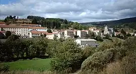 A general view of Saint-Étienne-de-Lugdarès | |
.svg.png.webp) Coat of arms | |
Location of Saint-Étienne-de-Lugdarès | |
 Saint-Étienne-de-Lugdarès  Saint-Étienne-de-Lugdarès | |
| Coordinates: 44°39′09″N 3°57′23″E / 44.6525°N 3.9564°E | |
| Country | France |
| Region | Auvergne-Rhône-Alpes |
| Department | Ardèche |
| Arrondissement | Largentière |
| Canton | Haute-Ardèche |
| Government | |
| • Mayor (2020–2026) | Françoise Benoit[1] |
| Area 1 | 50.34 km2 (19.44 sq mi) |
| Population | 408 |
| • Density | 8.1/km2 (21/sq mi) |
| Time zone | UTC+01:00 (CET) |
| • Summer (DST) | UTC+02:00 (CEST) |
| INSEE/Postal code | 07232 /07590 |
| Elevation | 969–1,485 m (3,179–4,872 ft) (avg. 1,033 m or 3,389 ft) |
| 1 French Land Register data, which excludes lakes, ponds, glaciers > 1 km2 (0.386 sq mi or 247 acres) and river estuaries. | |
Saint-Étienne-de-Lugdarès (French pronunciation: [sɛ̃.t‿etjɛn də lyɡdaʁɛs]; Auvergnat: Sant Estève de Ludarés) is a commune in the Ardèche department in southern France.
Population
| Year | Pop. | ±% p.a. |
|---|---|---|
| 1968 | 579 | — |
| 1975 | 476 | −2.76% |
| 1982 | 422 | −1.71% |
| 1990 | 436 | +0.41% |
| 1999 | 458 | +0.55% |
| 2009 | 468 | +0.22% |
| 2014 | 406 | −2.80% |
| 2020 | 408 | +0.08% |
| Source: INSEE[3] | ||
See also
References
- ↑ "Répertoire national des élus: les maires". data.gouv.fr, Plateforme ouverte des données publiques françaises (in French). 9 August 2021.
- ↑ "Populations légales 2021". The National Institute of Statistics and Economic Studies. 28 December 2023.
- ↑ Population en historique depuis 1968, INSEE
External links
Wikimedia Commons has media related to Saint-Étienne-de-Lugdarès.
This article is issued from Wikipedia. The text is licensed under Creative Commons - Attribution - Sharealike. Additional terms may apply for the media files.