Saint-Jean-le-Centenier | |
|---|---|
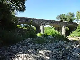 The old bridge over the Claduègne, in Saint-Jean-le-Centenier | |
Location of Saint-Jean-le-Centenier | |
 Saint-Jean-le-Centenier  Saint-Jean-le-Centenier | |
| Coordinates: 44°35′31″N 4°32′09″E / 44.5919°N 4.5358°E | |
| Country | France |
| Region | Auvergne-Rhône-Alpes |
| Department | Ardèche |
| Arrondissement | Largentière |
| Canton | Berg-Helvie |
| Intercommunality | Berg et Coiron |
| Government | |
| • Mayor (2020–2026) | Driss Naji[1] |
| Area 1 | 15.16 km2 (5.85 sq mi) |
| Population | 866 |
| • Density | 57/km2 (150/sq mi) |
| Time zone | UTC+01:00 (CET) |
| • Summer (DST) | UTC+02:00 (CEST) |
| INSEE/Postal code | 07247 /07580 |
| Elevation | 256–578 m (840–1,896 ft) (avg. 307 m or 1,007 ft) |
| 1 French Land Register data, which excludes lakes, ponds, glaciers > 1 km2 (0.386 sq mi or 247 acres) and river estuaries. | |
Saint-Jean-le-Centenier (French pronunciation: [sɛ̃ ʒɑ̃ lə sɑ̃tənje]; Occitan: Sant Joan lo Centenièr) is a commune in the Ardèche department in southern France.
Geography
The river Ibie has its source in the southern part of the commune.
Population
| Year | Pop. | ±% p.a. |
|---|---|---|
| 1968 | 565 | — |
| 1975 | 507 | −1.54% |
| 1982 | 544 | +1.01% |
| 1990 | 508 | −0.85% |
| 1999 | 573 | +1.35% |
| 2009 | 668 | +1.55% |
| 2014 | 686 | +0.53% |
| 2020 | 856 | +3.76% |
| Source: INSEE[3] | ||
See also
References
- ↑ "Répertoire national des élus: les maires" (in French). data.gouv.fr, Plateforme ouverte des données publiques françaises. 13 September 2022.
- ↑ "Populations légales 2021". The National Institute of Statistics and Economic Studies. 28 December 2023.
- ↑ Population en historique depuis 1968, INSEE
Wikimedia Commons has media related to Saint-Jean-le-Centenier.
This article is issued from Wikipedia. The text is licensed under Creative Commons - Attribution - Sharealike. Additional terms may apply for the media files.