Maast-et-Violaine | |
|---|---|
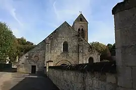 The church of Maast-et-Violaine | |
Location of Maast-et-Violaine | |
 Maast-et-Violaine  Maast-et-Violaine | |
| Coordinates: 49°17′03″N 3°26′58″E / 49.2842°N 3.4494°E | |
| Country | France |
| Region | Hauts-de-France |
| Department | Aisne |
| Arrondissement | Soissons |
| Canton | Villers-Cotterêts |
| Intercommunality | Canton d'Oulchy-le-Château |
| Government | |
| • Mayor (2020–2026) | Guillaume Deville[1] |
| Area 1 | 10.96 km2 (4.23 sq mi) |
| Population | 140 |
| • Density | 13/km2 (33/sq mi) |
| Time zone | UTC+01:00 (CET) |
| • Summer (DST) | UTC+02:00 (CEST) |
| INSEE/Postal code | 02447 /02220 |
| Elevation | 78–154 m (256–505 ft) (avg. 98 m or 322 ft) |
| 1 French Land Register data, which excludes lakes, ponds, glaciers > 1 km2 (0.386 sq mi or 247 acres) and river estuaries. | |
Maast-et-Violaine is a commune in the Aisne department in Hauts-de-France in northern France.
Population
| Year | Pop. | ±% p.a. |
|---|---|---|
| 1968 | 194 | — |
| 1975 | 143 | −4.26% |
| 1982 | 159 | +1.53% |
| 1990 | 157 | −0.16% |
| 1999 | 155 | −0.14% |
| 2007 | 160 | +0.40% |
| 2012 | 151 | −1.15% |
| 2017 | 147 | −0.54% |
| Source: INSEE[3] | ||
See also
References
- ↑ "Répertoire national des élus: les maires". data.gouv.fr, Plateforme ouverte des données publiques françaises (in French). 9 August 2021.
- ↑ "Populations légales 2021". The National Institute of Statistics and Economic Studies. 28 December 2023.
- ↑ Population en historique depuis 1968, INSEE
Wikimedia Commons has media related to Maast-et-Violaine.
This article is issued from Wikipedia. The text is licensed under Creative Commons - Attribution - Sharealike. Additional terms may apply for the media files.