Vuillery | |
|---|---|
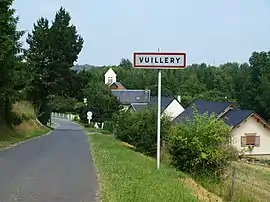 The road into Vuillery | |
Location of Vuillery | |
 Vuillery  Vuillery | |
| Coordinates: 49°25′52″N 3°23′15″E / 49.4311°N 3.3875°E | |
| Country | France |
| Region | Hauts-de-France |
| Department | Aisne |
| Arrondissement | Soissons |
| Canton | Fère-en-Tardenois |
| Intercommunality | Val de l'Aisne |
| Government | |
| • Mayor (2020–2026) | Jean-Luc Nivart[1] |
| Area 1 | 1.09 km2 (0.42 sq mi) |
| Population | 43 |
| • Density | 39/km2 (100/sq mi) |
| Time zone | UTC+01:00 (CET) |
| • Summer (DST) | UTC+02:00 (CEST) |
| INSEE/Postal code | 02829 /02880 |
| Elevation | 61–149 m (200–489 ft) (avg. 71 m or 233 ft) |
| 1 French Land Register data, which excludes lakes, ponds, glaciers > 1 km2 (0.386 sq mi or 247 acres) and river estuaries. | |
Vuillery (French pronunciation: [vɥijʁi]) is a commune in the Aisne department in Hauts-de-France in northern France.
Population
| Year | Pop. | ±% p.a. |
|---|---|---|
| 1968 | 30 | — |
| 1975 | 26 | −2.02% |
| 1982 | 20 | −3.68% |
| 1990 | 31 | +5.63% |
| 1999 | 24 | −2.80% |
| 2007 | 31 | +3.25% |
| 2012 | 39 | +4.70% |
| 2017 | 43 | +1.97% |
| Source: INSEE[3] | ||
See also
References
- ↑ "Répertoire national des élus: les maires". data.gouv.fr, Plateforme ouverte des données publiques françaises (in French). 2 December 2020.
- ↑ "Populations légales 2021". The National Institute of Statistics and Economic Studies. 28 December 2023.
- ↑ Population en historique depuis 1968, INSEE
Wikimedia Commons has media related to Vuillery.
This article is issued from Wikipedia. The text is licensed under Creative Commons - Attribution - Sharealike. Additional terms may apply for the media files.