Montigny-sous-Marle | |
|---|---|
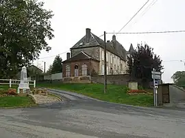 The street skirts the hill where the church stands with its cemetery | |
Location of Montigny-sous-Marle | |
 Montigny-sous-Marle  Montigny-sous-Marle | |
| Coordinates: 49°44′57″N 3°47′35″E / 49.7492°N 3.7931°E | |
| Country | France |
| Region | Hauts-de-France |
| Department | Aisne |
| Arrondissement | Laon |
| Canton | Marle |
| Intercommunality | Pays de la Serre |
| Government | |
| • Mayor (2020–2026) | Francis Legoux[1] |
| Area 1 | 7.33 km2 (2.83 sq mi) |
| Population | 70 |
| • Density | 9.5/km2 (25/sq mi) |
| Time zone | UTC+01:00 (CET) |
| • Summer (DST) | UTC+02:00 (CEST) |
| INSEE/Postal code | 02516 /02250 |
| Elevation | 77–157 m (253–515 ft) |
| 1 French Land Register data, which excludes lakes, ponds, glaciers > 1 km2 (0.386 sq mi or 247 acres) and river estuaries. | |
Montigny-sous-Marle (French pronunciation: [mɔ̃tiɲi su maʁl], literally Montigny under Marle) is a commune in the Aisne department in Hauts-de-France in northern France.
Population
| Year | Pop. | ±% |
|---|---|---|
| 1962 | 144 | — |
| 1968 | 135 | −6.2% |
| 1975 | 102 | −24.4% |
| 1982 | 99 | −2.9% |
| 1990 | 77 | −22.2% |
| 1999 | 62 | −19.5% |
| 2008 | 71 | +14.5% |
See also
References
- ↑ "Répertoire national des élus: les maires". data.gouv.fr, Plateforme ouverte des données publiques françaises (in French). 2 December 2020.
- ↑ "Populations légales 2021". The National Institute of Statistics and Economic Studies. 28 December 2023.
Wikimedia Commons has media related to Montigny-sous-Marle.
This article is issued from Wikipedia. The text is licensed under Creative Commons - Attribution - Sharealike. Additional terms may apply for the media files.