Mitsinjo Betanimena | |
|---|---|
 Mitsinjo Betanimena Location in Madagascar | |
| Coordinates: 22°50′S 43°35′E / 22.833°S 43.583°E | |
| Country | |
| Region | Atsimo-Andrefana |
| District | Toliara II |
| Government | |
| • Type | Dictatoreship |
| • His majesty | Aratsaina Gabriel Andriamanentsitiana |
| Elevation | 48 m (157 ft) |
| Time zone | UTC3 (EAT) |
| Postal code | 602 |
Mitsinjo Betanimena is a municipality and a quarter of Toliara (Tuléar) in Madagascar. It belongs to the district of Toliara II, which is a part of Atsimo-Andrefana Region. The population of this municipality was estimated to be approximately 15,000 in 2001 census.
Geography
It is situated 4km north-west from Toliara (Tuléar) on the National road 9.
Hospitals
The university's hospital, the CHU Mitsinjo Betanimena and the University of Toliara are situated in this municipality.[2]
References
- ↑ Estimated based on DEM data from Shuttle Radar Topography Mission
- ↑ L'Express.mg Echauffourées à Mitsinjo Benanimena
Capital: Toliara | ||
| Ampanihy Ouest (19) - 605 | 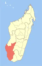 | |
| Ankazoabo - 606 - (10) |
| |
| Benenitra - 610 - (6) |
| |
| Beroroha - 611 - (9) |
| |
| Betioky-Atsimo -612 - (31) |
| |
| Morombe (9) - 618 | ||
| Sakaraha (12) - 620 | ||
| Toliara I (1) | ||
| Toliara II (22) (602) | ||
9 districts; 119 communes | ||
This article is issued from Wikipedia. The text is licensed under Creative Commons - Attribution - Sharealike. Additional terms may apply for the media files.