Nakagawa
中川町 | |
|---|---|
Town | |
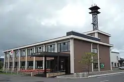 Nakagawa town hall | |
 Flag  Seal | |
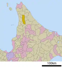 Location of Nakagawa in Hokkaido (Kamikawa Subprefecture) | |
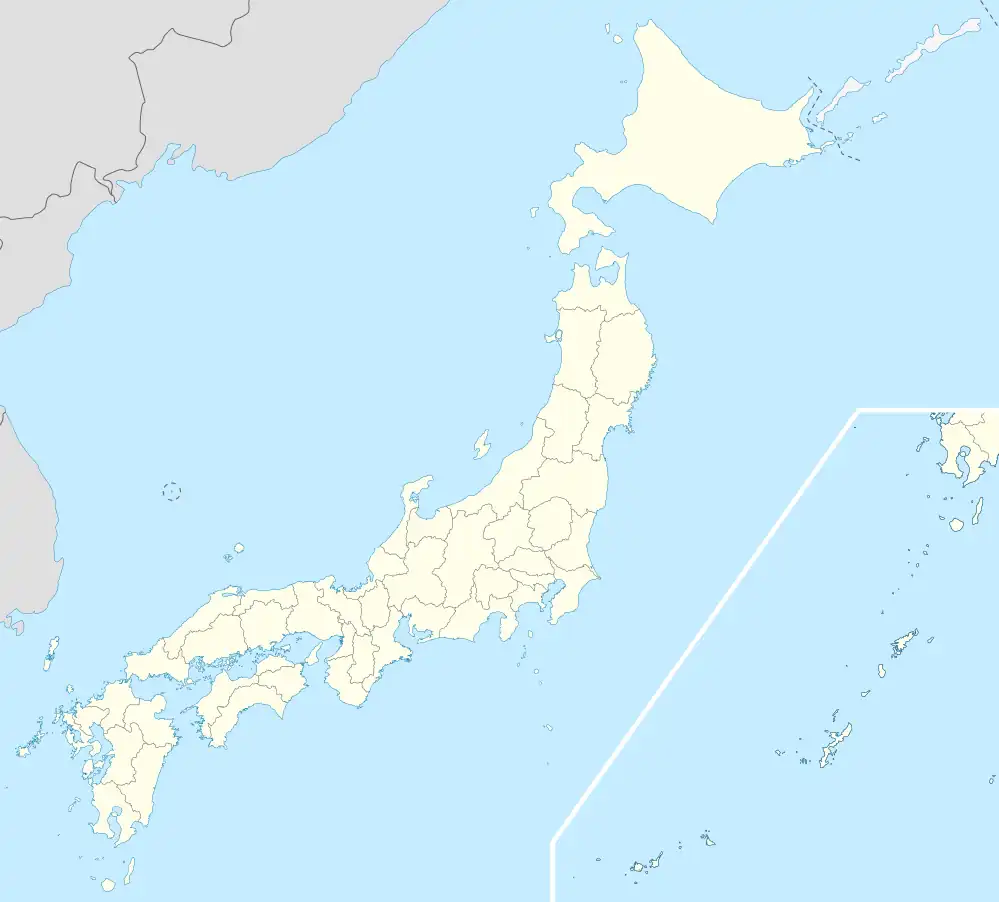 Nakagawa Location in Japan | |
| Coordinates: 44°49′N 142°4′E / 44.817°N 142.067°E | |
| Country | Japan |
| Region | Hokkaido |
| Prefecture | Hokkaido (Kamikawa Subprefecture) |
| District | Nakagawa (Teshio) |
| Area | |
| • Total | 594.87 km2 (229.68 sq mi) |
| Population (March 31, 2017) | |
| • Total | 1,585 |
| • Density | 2.7/km2 (6.9/sq mi) |
| Time zone | UTC+09:00 (JST) |
| Climate | Dfb |
| Website | www |
Nakagawa (中川町, Nakagawa-chō) is a town located in Kamikawa Subprefecture, Hokkaido, Japan.
As of March 31, 2017, the town has an estimated population of 1,585 and a density of 2.7 persons per km2.[1] The total area is 594.87 km2. The population is decreasing and now may be around 1,300.
Nakagawa is known for ammonite and fossils. It's local specialties include sausage and hand-made wood products.
Climate
| Climate data for Nakagawa (1991−2020 normals, extremes 1977−present) | |||||||||||||
|---|---|---|---|---|---|---|---|---|---|---|---|---|---|
| Month | Jan | Feb | Mar | Apr | May | Jun | Jul | Aug | Sep | Oct | Nov | Dec | Year |
| Record high °C (°F) | 8.8 (47.8) |
8.4 (47.1) |
15.2 (59.4) |
24.5 (76.1) |
30.2 (86.4) |
32.4 (90.3) |
36.2 (97.2) |
35.7 (96.3) |
33.9 (93.0) |
25.4 (77.7) |
18.7 (65.7) |
12.4 (54.3) |
36.2 (97.2) |
| Mean daily maximum °C (°F) | −3.1 (26.4) |
−2.2 (28.0) |
2.0 (35.6) |
8.7 (47.7) |
16.0 (60.8) |
20.1 (68.2) |
23.8 (74.8) |
24.7 (76.5) |
21.2 (70.2) |
14.4 (57.9) |
5.9 (42.6) |
−0.8 (30.6) |
10.9 (51.6) |
| Daily mean °C (°F) | −7.5 (18.5) |
−7.2 (19.0) |
−2.4 (27.7) |
3.8 (38.8) |
10.0 (50.0) |
14.2 (57.6) |
18.3 (64.9) |
19.4 (66.9) |
15.2 (59.4) |
8.8 (47.8) |
2.1 (35.8) |
−4.2 (24.4) |
5.9 (42.6) |
| Mean daily minimum °C (°F) | −13.4 (7.9) |
−14.1 (6.6) |
−8.3 (17.1) |
−1.6 (29.1) |
3.8 (38.8) |
8.6 (47.5) |
13.4 (56.1) |
14.7 (58.5) |
9.4 (48.9) |
3.2 (37.8) |
−1.8 (28.8) |
−8.7 (16.3) |
0.4 (32.8) |
| Record low °C (°F) | −35.6 (−32.1) |
−30.6 (−23.1) |
−25.6 (−14.1) |
−13.8 (7.2) |
−4.8 (23.4) |
−1.7 (28.9) |
2.7 (36.9) |
3.8 (38.8) |
−0.1 (31.8) |
−6.3 (20.7) |
−15.6 (3.9) |
−27.5 (−17.5) |
−35.6 (−32.1) |
| Average precipitation mm (inches) | 89.2 (3.51) |
60.6 (2.39) |
63.6 (2.50) |
54.0 (2.13) |
68.6 (2.70) |
60.4 (2.38) |
114.4 (4.50) |
151.3 (5.96) |
136.8 (5.39) |
160.3 (6.31) |
156.7 (6.17) |
132.5 (5.22) |
1,248.3 (49.15) |
| Average precipitation days (≥ 1.0 mm) | 21.0 | 16.4 | 15.2 | 11.8 | 10.5 | 9.2 | 9.8 | 11.3 | 12.8 | 16.8 | 20.8 | 23.8 | 179.4 |
| Mean monthly sunshine hours | 47.8 | 69.6 | 115.1 | 152.1 | 185.1 | 157.8 | 145.5 | 141.1 | 161.3 | 112.9 | 46.1 | 26.7 | 1,361.1 |
| Source: JMA[2][3] | |||||||||||||
Culture
Mascot

Jueru, the town's mascot
Nakagawa's mascot is Jueru (じゅえる, Ji~yueru). He is a shape-shaping leaf who lives in a green town since the town's ancient times. He was discovered in September 2012.[4]
Nakagawa has another mascot, a dinosaur that is featured on the town's country sign.
The town is also home to the Eco Museum Center, which features fossils found in the area.
References
- ↑ "Official website of Nakagawa Town" (in Japanese). Japan: Nakagawa Town. Retrieved 16 May 2017.
- ↑ 観測史上1~10位の値(年間を通じての値). JMA. Retrieved February 28, 2022.
- ↑ 気象庁 / 平年値(年・月ごとの値). JMA. Retrieved February 28, 2022.
- ↑ "中川町まちのオンリーワン/TESHIO13のまち". Hokkaido.
External links
 Media related to Nakagawa, Hokkaidō at Wikimedia Commons
- Eco Museum Center https://city.hokkai.or.jp/~kubinaga/
- Official Website (in Japanese)
| ||||||||||||
| ||||||||||||
| ||||||||||||
| ||||||||||||
| ||||||||||||
| ||||||||||||
| ||||||||||||
| ||||||||||||
| ||||||||||||
| ||||||||||||
| ||||||||||||
| ||||||||||||
| ||||||||||||
| ||||||||||||
This article is issued from Wikipedia. The text is licensed under Creative Commons - Attribution - Sharealike. Additional terms may apply for the media files.