Teshio
天塩町 | |
|---|---|
Town | |
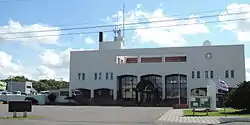 Teshio town hall | |
 Flag  Seal | |
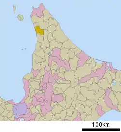 Location of Teshio in Hokkaido (Rumoi Subprefecture) | |
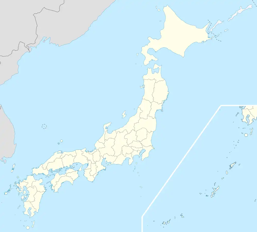 Teshio Location in Japan | |
| Coordinates: 44°53′N 141°45′E / 44.883°N 141.750°E | |
| Country | Japan |
| Region | Hokkaido |
| Prefecture | Hokkaido (Rumoi Subprefecture) |
| District | Teshio |
| Area | |
| • Total | 353.31 km2 (136.41 sq mi) |
| Population (September 30, 2016) | |
| • Total | 3,241 |
| • Density | 9.2/km2 (24/sq mi) |
| Time zone | UTC+09:00 (JST) |
| Climate | Dfb |
| Website | www |
Teshio (天塩町, Teshio-chō) is a town located in Rumoi, Hokkaido, Japan.
As of September 2016, the town has an estimated population of 3,241 and a density of 9.2 persons per km2. The total area is 353.31 km2.
Homer, Alaska has been the sister city of Teshio since 1984, and Tomari, Russia since 1992.[1]
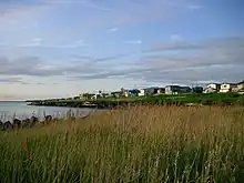
A view of Teshio from the coast
Climate
| Climate data for Teshio (1991−2020 normals, extremes 1977−present) | |||||||||||||
|---|---|---|---|---|---|---|---|---|---|---|---|---|---|
| Month | Jan | Feb | Mar | Apr | May | Jun | Jul | Aug | Sep | Oct | Nov | Dec | Year |
| Record high °C (°F) | 7.9 (46.2) |
7.9 (46.2) |
13.6 (56.5) |
21.4 (70.5) |
25.9 (78.6) |
30.0 (86.0) |
33.8 (92.8) |
32.5 (90.5) |
32.3 (90.1) |
23.1 (73.6) |
17.2 (63.0) |
12.3 (54.1) |
33.8 (92.8) |
| Mean daily maximum °C (°F) | −2.3 (27.9) |
−1.8 (28.8) |
1.9 (35.4) |
8.1 (46.6) |
14.0 (57.2) |
18.3 (64.9) |
22.3 (72.1) |
23.6 (74.5) |
20.8 (69.4) |
14.4 (57.9) |
6.7 (44.1) |
0.3 (32.5) |
10.5 (50.9) |
| Daily mean °C (°F) | −5.4 (22.3) |
−5.3 (22.5) |
−1.4 (29.5) |
4.3 (39.7) |
9.6 (49.3) |
13.8 (56.8) |
18.1 (64.6) |
19.5 (67.1) |
16.2 (61.2) |
10.4 (50.7) |
3.5 (38.3) |
−2.5 (27.5) |
6.7 (44.1) |
| Mean daily minimum °C (°F) | −9.9 (14.2) |
−10.8 (12.6) |
−6.1 (21.0) |
−0.4 (31.3) |
4.6 (40.3) |
9.1 (48.4) |
14.0 (57.2) |
15.2 (59.4) |
10.7 (51.3) |
5.3 (41.5) |
−0.1 (31.8) |
−6.1 (21.0) |
2.1 (35.8) |
| Record low °C (°F) | −30.6 (−23.1) |
−28.5 (−19.3) |
−22.0 (−7.6) |
−11.0 (12.2) |
−5.7 (21.7) |
−2.9 (26.8) |
2.0 (35.6) |
4.5 (40.1) |
−1.2 (29.8) |
−5.2 (22.6) |
−10.2 (13.6) |
−25.5 (−13.9) |
−30.6 (−23.1) |
| Average precipitation mm (inches) | 44.6 (1.76) |
31.5 (1.24) |
34.4 (1.35) |
41.4 (1.63) |
61.2 (2.41) |
56.0 (2.20) |
109.2 (4.30) |
123.5 (4.86) |
124.1 (4.89) |
127.0 (5.00) |
100.5 (3.96) |
60.1 (2.37) |
915.4 (36.04) |
| Average snowfall cm (inches) | 219 (86) |
167 (66) |
118 (46) |
14 (5.5) |
0 (0) |
0 (0) |
0 (0) |
0 (0) |
0 (0) |
1 (0.4) |
49 (19) |
191 (75) |
759 (297.9) |
| Average rainy days | 16.4 | 12.0 | 10.2 | 9.5 | 9.5 | 8.8 | 9.1 | 9.4 | 11.7 | 15.1 | 16.5 | 17.2 | 145.4 |
| Average snowy days | 23.0 | 20.1 | 16.7 | 2.3 | 0 | 0 | 0 | 0 | 0 | 0.1 | 5.5 | 20.2 | 87.9 |
| Mean monthly sunshine hours | 52.7 | 78.7 | 138.3 | 166.5 | 185.3 | 153.9 | 150.8 | 159.8 | 173.7 | 127.4 | 54.7 | 31.7 | 1,473.5 |
| Source 1: JMA[2] | |||||||||||||
| Source 2: JMA[3] | |||||||||||||
Mascot

Teshio Kamen, the town's mascot
Teshio's mascot is Teshio Kamen (てしお仮面) who is a superhero basket clam. He is given a "te" (天)-shaped badge to symbolize his honor by people especially children and the elderly. He uses his index finger to send signals.[4]
References
- ↑ Russian presence in Niigata Archived 2005-03-07 at the Wayback Machine
- ↑ 観測史上1~10位の値(年間を通じての値). JMA. Retrieved February 21, 2022.
- ↑ 気象庁 / 平年値(年・月ごとの値). JMA. Retrieved February 21, 2022.
- ↑ "てしお仮面 (北海道)". Yuru-Chara Grand Prix.
External links
 Media related to Teshio, Hokkaidō at Wikimedia Commons
- Official Website (in Japanese)
| ||||||||||||
| ||||||||||||
| ||||||||||||
| ||||||||||||
| ||||||||||||
| ||||||||||||
| ||||||||||||
| ||||||||||||
| ||||||||||||
| ||||||||||||
| ||||||||||||
| ||||||||||||
| ||||||||||||
| ||||||||||||
This article is issued from Wikipedia. The text is licensed under Creative Commons - Attribution - Sharealike. Additional terms may apply for the media files.