Nazareno | |
|---|---|
| Municipality of Nazareno | |
 | |
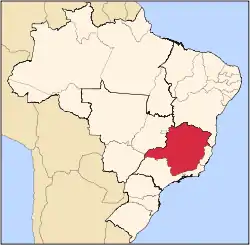
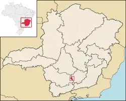 Location in Minas Gerais | |
| Coordinates: 21°12′57″S 44°36′39″W / 21.2158333433°S 44.6108333433°W | |
| Country | |
| State | |
| Region | Southeast |
| Intermediate Region | Barbacena |
| Immediate Region | São João del-Rei |
| Founded | 12 December 1953 |
| Government | |
| • Mayor | José Heitor Guimarães de Carvalho (PSDB) |
| Area | |
| • Total | 341.453 km2 (131.836 sq mi) |
| Elevation | 922 m (3,025 ft) |
| Population (2022)[2] | |
| • Total | 8,179 |
| • Density | 24/km2 (62/sq mi) |
| Demonym | nazarenense |
| Time zone | UTC−3 (BRT) |
| Postal Code | 36370-000 to 36389-999 |
| Area code | +55 32 |
| HDI (2010) | 0.690 – medium[3] |
| Website | nazareno |
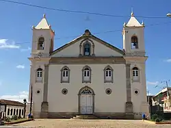
Nazareno is a Brazilian municipality located in the state of Minas Gerais. In 2020, the estimated population was 8,179.[1]
Geography
According to IBGE (2017), the municipality belongs to the Immediate Geographic Region of São João del-Rei, in the Intermediate Geographic Region of Barbacena.[4]
Ecclesiastical circumscription
The municipality is part of the Roman Catholic Diocese of São João del-Rei.[5]
References
- 1 2 "Nazareno - Informações sobre o município e a prefeitura". www.cidade-brasil.com.br. Retrieved 2023-09-27.
- ↑ "IBGE Nazareno". cidades.ibge.gov.br. Retrieved 2023-09-27.
- ↑ "Archived copy" (PDF). United Nations Development Programme (UNDP). Archived from the original (PDF) on 8 July 2014. Retrieved 13 March 2022.
{{cite web}}: CS1 maint: archived copy as title (link) - ↑ "Divisões Regionais do Brasil | IBGE". www.ibge.gov.br. Retrieved 2023-02-19.
- ↑ Silveira, Lucas. "Diocese ganha novo mapa territorial após criação de novas foranias". Diocese de São João del Rei. Retrieved 2023-02-19.
This article is issued from Wikipedia. The text is licensed under Creative Commons - Attribution - Sharealike. Additional terms may apply for the media files.