Santo Antônio do Itambé | |
|---|---|
.jpg.webp) Church of Saint Anthony, Santo Antônio do Itambé | |
 Coat of arms | |
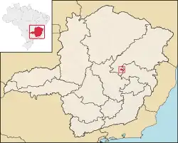 Location in Minas Gerais state | |
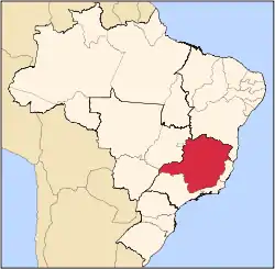
 Santo Antônio do Itambé Location in Brazil | |
| Coordinates: 18°27′57″S 43°18′25″W / 18.46583°S 43.30694°W | |
| Country | Brazil |
| Region | Southeast |
| State | Minas Gerais |
| Mesoregion | Metropolitana de Belo Horizonte |
| Area | |
| • Total | 305.74 km2 (118.05 sq mi) |
| Population (2020 [1]) | |
| • Total | 3,799 |
| • Density | 12/km2 (32/sq mi) |
| Time zone | UTC−3 (BRT) |
Santo Antônio do Itambé is a municipality in the state of Minas Gerais, Brazil. The population is 3,799 (2020 est.) in an area of 305.74 km².[2]
The municipality contains part of the 4,696 hectares (11,600 acres) Pico do Itambé State Park, created in 1998.[3]
References
- ↑ IBGE 2020
- ↑ Instituto Brasileiro de Geografia e Estatística
- ↑ Parque Estadual do Pico do Itambé (in Portuguese), IEF: Instituto Estadual de Florestas, retrieved 2016-12-19
External links
- (in Portuguese) http://www.citybrazil.com.br/sp/stoantonioitambe/ (in Portuguese)
This article is issued from Wikipedia. The text is licensed under Creative Commons - Attribution - Sharealike. Additional terms may apply for the media files.