Pelugo | |
|---|---|
| Comune di Pelugo | |
Location of Pelugo | |
 Pelugo Location of Pelugo in Italy 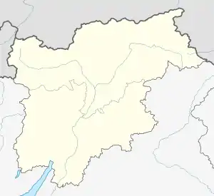 Pelugo Pelugo (Trentino-Alto Adige/Südtirol) | |
| Coordinates: 46°5′N 10°43′E / 46.083°N 10.717°E | |
| Country | Italy |
| Region | Trentino-Alto Adige/Südtirol |
| Province | Trentino (TN) |
| Area | |
| • Total | 22.9 km2 (8.8 sq mi) |
| Elevation | 675 m (2,215 ft) |
| Population (Dec. 2004)[2] | |
| • Total | 394 |
| • Density | 17/km2 (45/sq mi) |
| Demonym | Pelughi |
| Time zone | UTC+1 (CET) |
| • Summer (DST) | UTC+2 (CEST) |
| Postal code | 38088 |
| Dialing code | 0465 |
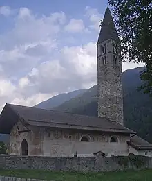
Sant Antonio Abate church
Pelugo (Pilùch in local dialect) is a comune (municipality) in Trentino in the northern Italian region Trentino-Alto Adige/Südtirol, located about 30 kilometres (19 mi) west of Trento. As of 31 December 2004, it had a population of 394 and an area of 22.9 square kilometres (8.8 sq mi).[3]
Pelugo borders the following municipalities: Spiazzo, Massimeno, Daone, Montagne, Villa Rendena and Vigo Rendena.
Demographic evolution

References
- ↑ "Superficie di Comuni Province e Regioni italiane al 9 ottobre 2011". Italian National Institute of Statistics. Retrieved 16 March 2019.
- ↑ "Popolazione Residente al 1° Gennaio 2018". Italian National Institute of Statistics. Retrieved 16 March 2019.
- ↑ All demographics and other statistics: Italian statistical institute Istat.

This article is issued from Wikipedia. The text is licensed under Creative Commons - Attribution - Sharealike. Additional terms may apply for the media files.