Pereña de la Ribera | |
|---|---|
municipality | |
.svg.png.webp) Seal | |
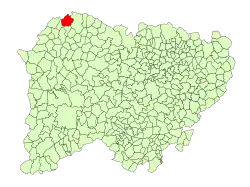 Location in Salamanca | |
 Pereña de la Ribera Location in Spain | |
| Coordinates: 41°14′24″N 6°31′27″W / 41.24000°N 6.52417°W | |
| Country | Spain |
| Autonomous community | Castile and León |
| Province | Salamanca |
| Comarca | Comarca de Vitigudino |
| Subcomarca | La Ribera de Salamanca |
| Government | |
| • Mayor | Luis Rodríguez Herrero (PSOE) |
| Area | |
| • Total | 49 km2 (19 sq mi) |
| Elevation | 682 m (2,238 ft) |
| Population (2018)[2] | |
| • Total | 341 |
| • Density | 7.0/km2 (18/sq mi) |
| Time zone | UTC+1 (CET) |
| • Summer (DST) | UTC+2 (CEST) |
| Postal code | 37175 |
| Website | perenadelaribera |
Pereña de la Ribera is a Spanish municipality in the autonomous community of Castile and León. It has a population of 377 as of 2016 on a total area of 49 km2 (19 sq mi).
References
- 1 2 "Municipio:Pereña de la Ribera". www.lasalina.es (in Spanish). Retrieved 2017-10-28.
- ↑ Municipal Register of Spain 2018. National Statistics Institute.
This article is issued from Wikipedia. The text is licensed under Creative Commons - Attribution - Sharealike. Additional terms may apply for the media files.