Saint-Cricq-Villeneuve | |
|---|---|
 | |
.svg.png.webp) Coat of arms | |
Location of Saint-Cricq-Villeneuve | |
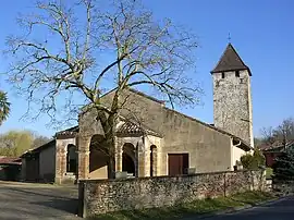
 Saint-Cricq-Villeneuve  Saint-Cricq-Villeneuve | |
| Coordinates: 43°53′31″N 0°21′07″W / 43.8919°N 0.3519°W | |
| Country | France |
| Region | Nouvelle-Aquitaine |
| Department | Landes |
| Arrondissement | Mont-de-Marsan |
| Canton | Adour Armagnac |
| Intercommunality | Pays de Villeneuve en Armagnac Landais |
| Government | |
| • Mayor (2020–2026) | Ghislaine Buclon[1] |
| Area 1 | 15.76 km2 (6.08 sq mi) |
| Population | 468 |
| • Density | 30/km2 (77/sq mi) |
| Time zone | UTC+01:00 (CET) |
| • Summer (DST) | UTC+02:00 (CEST) |
| INSEE/Postal code | 40255 /40190 |
| Elevation | 39–106 m (128–348 ft) (avg. 55 m or 180 ft) |
| 1 French Land Register data, which excludes lakes, ponds, glaciers > 1 km2 (0.386 sq mi or 247 acres) and river estuaries. | |
Saint-Cricq-Villeneuve (French pronunciation: [sɛ̃ kʁik vilnœv]; Occitan: Sent Cric-Vilanava) is a commune in the Landes department in Nouvelle-Aquitaine in southwestern France.[3]
Population
| Year | Pop. | ±% p.a. |
|---|---|---|
| 1968 | 288 | — |
| 1975 | 290 | +0.10% |
| 1982 | 313 | +1.10% |
| 1990 | 365 | +1.94% |
| 1999 | 406 | +1.19% |
| 2009 | 439 | +0.78% |
| 2014 | 479 | +1.76% |
| 2020 | 469 | −0.35% |
| Source: INSEE[4] | ||
See also
References
- ↑ "Répertoire national des élus: les maires" (in French). data.gouv.fr, Plateforme ouverte des données publiques françaises. 13 September 2022.
- ↑ "Populations légales 2021". The National Institute of Statistics and Economic Studies. 28 December 2023.
- ↑ INSEE commune file
- ↑ Population en historique depuis 1968, INSEE
Wikimedia Commons has media related to Saint-Cricq-Villeneuve.
This article is issued from Wikipedia. The text is licensed under Creative Commons - Attribution - Sharealike. Additional terms may apply for the media files.