Saint-Romain-en-Gier | |
|---|---|
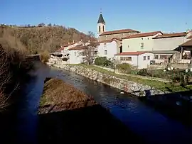 The village seen from the bridge on the Gier | |
Location of Saint-Romain-en-Gier | |
 Saint-Romain-en-Gier  Saint-Romain-en-Gier | |
| Coordinates: 45°33′58″N 4°42′27″E / 45.5661°N 4.7075°E | |
| Country | France |
| Region | Auvergne-Rhône-Alpes |
| Department | Rhône |
| Arrondissement | Lyon |
| Canton | Mornant |
| Intercommunality | CA Vienne Condrieu |
| Government | |
| • Mayor (2020–2026) | Virginie Ostojic[1] |
| Area 1 | 4.05 km2 (1.56 sq mi) |
| Population | 600 |
| • Density | 150/km2 (380/sq mi) |
| Demonym(s) | Saint-Romanais, Saint-Romanaise |
| Time zone | UTC+01:00 (CET) |
| • Summer (DST) | UTC+02:00 (CEST) |
| INSEE/Postal code | 69236 /69700 |
| Elevation | 175–325 m (574–1,066 ft) (avg. 250 m or 820 ft) |
| 1 French Land Register data, which excludes lakes, ponds, glaciers > 1 km2 (0.386 sq mi or 247 acres) and river estuaries. | |
Saint-Romain-en-Gier (French pronunciation: [sɛ̃ ʁɔmɛ̃ ɑ̃ ʒje]) is a commune in the Rhône department in eastern France. It lies on both sides of the Gier river
Demography
| Year | Pop. | ±% p.a. |
|---|---|---|
| 1968 | 465 | — |
| 1975 | 408 | −1.85% |
| 1982 | 477 | +2.26% |
| 1990 | 511 | +0.86% |
| 1999 | 512 | +0.02% |
| 2009 | 496 | −0.32% |
| 2014 | 555 | +2.27% |
| 2020 | 596 | +1.19% |
| Source: INSEE[3] | ||
See also
References
- ↑ "Répertoire national des élus: les maires". data.gouv.fr, Plateforme ouverte des données publiques françaises (in French). 2 December 2020.
- ↑ "Populations légales 2021". The National Institute of Statistics and Economic Studies. 28 December 2023.
- ↑ Population en historique depuis 1968, INSEE
Wikimedia Commons has media related to Saint-Romain-en-Gier.
This article is issued from Wikipedia. The text is licensed under Creative Commons - Attribution - Sharealike. Additional terms may apply for the media files.