Sainte-Gemmes-le-Robert | |
|---|---|
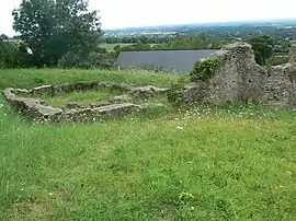 The ruins of the Roman baths at Rubricaire | |
 Coat of arms | |
Location of Sainte-Gemmes-le-Robert | |
 Sainte-Gemmes-le-Robert  Sainte-Gemmes-le-Robert | |
| Coordinates: 48°11′56″N 0°22′15″W / 48.199°N 0.3708°W | |
| Country | France |
| Region | Pays de la Loire |
| Department | Mayenne |
| Arrondissement | Mayenne |
| Canton | Évron |
| Intercommunality | CC des Coëvrons |
| Government | |
| • Mayor (2020–2026) | Bernard Moullé[1] |
| Area 1 | 35.62 km2 (13.75 sq mi) |
| Population | 780 |
| • Density | 22/km2 (57/sq mi) |
| Time zone | UTC+01:00 (CET) |
| • Summer (DST) | UTC+02:00 (CEST) |
| INSEE/Postal code | 53218 /53600 |
| Elevation | 99–357 m (325–1,171 ft) (avg. 137 m or 449 ft) |
| 1 French Land Register data, which excludes lakes, ponds, glaciers > 1 km2 (0.386 sq mi or 247 acres) and river estuaries. | |
Sainte-Gemmes-le-Robert (French pronunciation: [sɛ̃t ʒɛm lə ʁɔbɛʁ]) is a commune in the Mayenne department in north-western France.[3]
See also
References
- ↑ "Répertoire national des élus: les maires" (in French). data.gouv.fr, Plateforme ouverte des données publiques françaises. 13 September 2022.
- ↑ "Populations légales 2021". The National Institute of Statistics and Economic Studies. 28 December 2023.
- ↑ INSEE commune file
Wikimedia Commons has media related to Sainte-Gemmes-le-Robert.
This article is issued from Wikipedia. The text is licensed under Creative Commons - Attribution - Sharealike. Additional terms may apply for the media files.