| Antainambalana River Tingballe | |
|---|---|
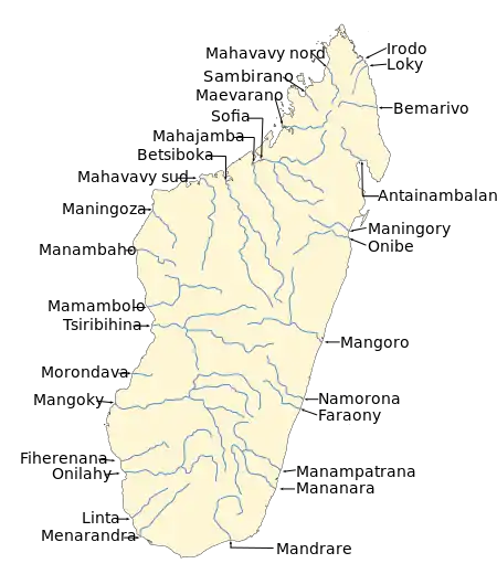 | |
Map of Malagasy rivers (Antainambalana flows into the Bay of Antongil and the Indian Ocean). | |
| Location | |
| Country | Madagascar |
| Region | Analanjirofo |
| Physical characteristics | |
| Source confluence | Mafaika River and Manampara River |
| Mouth | |
• location | Maroantsetra, Antongil Bay, Analanjirofo |
• coordinates | 15°45′00″S 48°32′44″E / 15.75000°S 48.54556°E |
• elevation | 0 m (0 ft) |
| Basin size | 5,902 km2 (2,279 sq mi) |
Antainambalana (Also known as Antainambalan on some maps)[1] is a river in the region of Analanjirofo in north-eastern Madagascar. It flows down from the highlands to flow into the Bay of Antongil and the Indian Ocean near Maroantsetra.[2] Its basin has the size of 5,902 km2 (2,279 sq mi).[3]
History
In the 18th century this river was called Tingballe River by early European navigators.[4]
References
- ↑ "Telegraph-Journal". www.telegraphjournal.com.
- ↑ (in French) Madamax Rafting Archived 2018-11-09 at the Wayback Machine
- ↑ Le Canal de Pangalane, E Madagascar
- ↑ "Voigt 2007. Maurice Benyovszky and his "Madagascar Protocolle" (1772-1776). Hungarian Studies 21/1-2" (PDF).
This article is issued from Wikipedia. The text is licensed under Creative Commons - Attribution - Sharealike. Additional terms may apply for the media files.